 Garnett 1850s-60s NY15


|

|
|
|
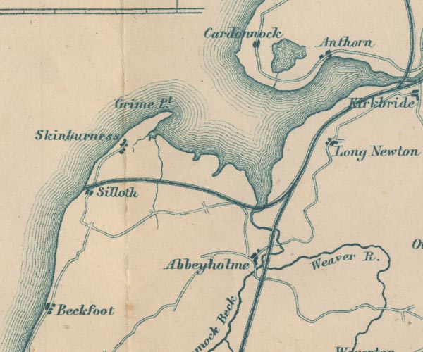
gazetteer links places may or may not be labelled on the map |
||

|
-- Abbey Town -- "Abbeyholme" |
|
|
|
-- Anthorn -- "Anthorn" |
|
|
|
-- Beckfoot -- "Beckfoot" |
|
|
|
-- Cardurnock -- "Cardunnock" |
|
|
|
-- Carlisle and Silloth Bay Railway |
|
|
|
-- Grune Point -- "Grune pt." |
|
|
|
-- Cardurnock Lough |
|
|
|
-- Moricambe |
|
|
|
-- Newton Arlosh -- "Long Newton" |
|
|
|
-- Silloth -- "Silloth" |
|
|
|
-- Skinburness -- "Skinburness" |
|
|
|
-- Solway Junction Railway |
|
|
|
-- Waver, River -- "Weaver R." -- "R.
Weaver" |
|
|
civil parishes The area roughly includes parts of parishes:- Holme Low Holme St Cuthbert Holme Abbey Holme East Waver Dundraw Silloth-on-Solway |
||
|
|
||
|
|
Lakes Guides menu. | |