 Ford 1839 map SD78


|

|
|
|
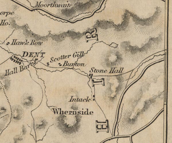
gazetteer links places may or may not be labelled on the map |
||

|
-- Bess Intake House -- "Intack" |
|
|
|
-- Birchen Tree -- "Burton" |
|
|
|
-- Hall Bank -- "Hall Barns" |
|
|
|
-- Scotchergill -- "Scotter Gill" |
|
|
|
-- Stone House -- "Stone Hall" |
|
|
|
-- Whernside -- "Whernside" |
|
|
civil parishes The area roughly includes parts of parishes:- Garsdale Dent Casterton |
||
|
|
||
|
|
Lakes Guides menu. | |