 Old Cumbria Gazetteer
 |
 |
|
||||||||||||||||||||
| Whernside, Dent | ||||||||||||||||||||||
| Whernside | ||||||||||||||||||||||
| civil parish:- | Dent (formerly Yorkshire) | |||||||||||||||||||||
| county:- | Cumbria | |||||||||||||||||||||
| locality type:- | hill | |||||||||||||||||||||
| coordinates:- | SD73858142 | |||||||||||||||||||||
| 1Km square:- | SD7381 | |||||||||||||||||||||
| 10Km square:- | SD78 | |||||||||||||||||||||
| altitude:- | 2415 feet | |||||||||||||||||||||
| altitude:- | 736m | |||||||||||||||||||||
| county:- | North Yorkshire | |||||||||||||||||||||
| current boundary | ||||||||||||||||||||||
| locality:- | Cumbria boundary | |||||||||||||||||||||
| county:- | ||||||||||||||||||||||
|
|
||||||||||||||||||||||
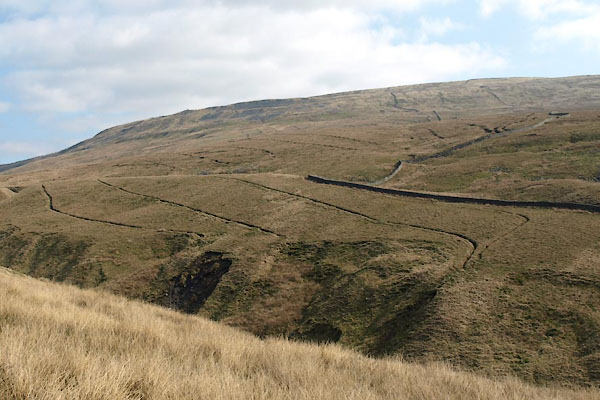 BUG09.jpg (taken 24.3.2011) |
||||||||||||||||||||||
|
|
||||||||||||||||||||||
| evidence:- | descriptive text:- West 1778 (11th edn 1821) placename:- Whernside |
|||||||||||||||||||||
| source data:- | Guide book, A Guide to the Lakes, by Thomas West, published by
William Pennington, Kendal, Cumbria once Westmorland, and in
London, 1778 to 1821. goto source goto sourcePage 190:- "A TABLE OF THE Height of Mountains and Lakes SEEN IN THIS TOUR, ... TAKEN FROM THE LEVEL OF THE SEA. ... by Mr. John Dalton." "Whernside, near Dent ... 825 [yards]" goto sourceTour to the Caves in the West Riding of Yorkshire, late 18th century Page 246:- "high mountains, some of them the loftiest of any in England - Whernside to the south-east, and Gragareth to the north. ... [from Kingsdale]" goto sourcePage 251:- "..." "[1] If the tourist would proceed immediately [from Ingleton] to Chapel-in-the-Dale, he may go either below Breada-garth to Twisleton, and then turn up the vale to Chapel-in-the-dale; or, which is a nearer road, he may cross Kingsdale above Breada-garth, and ascend the mountain, pursuing a rough and not well-defined road, taking care to keep on the south-west side of a swamp, near a hill, or a heap of stones called a hurder, on the base of Whernside, and then to turn round the west corner of the mountain: afterwards he must turn his course easterly, along the base of the mountain, till he comes to some lanes, any of which will lead him, by some houses, down to the chapel, in the middle of the vale between Whernside and Ingleborough." goto sourcePage 253:- "[at Ingleton] ... The church-yard, in the middle of which stands a neat sacred edifice, commands a fine view ... On the back-ground are the lofty mountains of Gragareth, Whernside, and Ingleborough, the summits of which, when they are not enveloped in the clouds, can scarcely be seen for their high intervening bases. ..." goto sourcePage 265:- "..." "... The country people are all persuaded that Whernside, on the north side of the vale of Chapel-in-the-Dale, is higher than Ingleborough, from snow continuing longer on its top, and other circumstances. The elevation appears so nearly the same to the eye, that nothing but an exact admeasurement can determine this honour for these rival, soaring candidates. ..." goto sourcePage 270:- "... Being [at Gatekirk] so near the top of Whernside, we ventured to ascend to the summit. The prospects were not diversified with many pleasing objects, being surrounded almost on all sides with brown and blue chaotic mountains. We had a peep into the pleasant vale of Dent beneath us, which made us wish to see it all. Pendle-hill appeared over the top of Ingleborough, which gave us a high idea of our own elevation, this latter mountain being much higher than the former. We were surprised to see four or five tarns, or pools of water, on a plain very near the summit of Whernside. Two of them were large, being two or three hundred yards in length, and nearly of the same breadth (for one was almost circular, but the other oblong.) There was a very thin bed of coal almost on the top of this mountain, and we were told another corresponded with it on the top of great Colm, a lofty mountain on the other side of that branch of the vale of Dent called Dibdale.- We were told some curious anecdotes of the vast cunning and sagacity of the sheep-dogs in this country, in discovering the sheep that had been buried under large drifts of snow for some days, and that must inevitably have perished with hunger, or been drowned with the melting of the that vapour, if not discovered by these useful animals." |
|||||||||||||||||||||
|
|
||||||||||||||||||||||
| evidence:- | descriptive text:- Otley 1823 (5th edn 1834) item:- latitude; longitude; lat and long |
|||||||||||||||||||||
| source data:- | Guide book, A Concise Description of the English Lakes, the
mountains in their vicinity, and the roads by which they may be
visited, with remarks on the mineralogy and geology of the
district, by Jonathan Otley, published by the author, Keswick,
Cumberland now Cumbria, by J Richardson, London, and by Arthur
Foster, Kirkby Lonsdale, Cumbria, 1823; published 1823-49,
latterly as the Descriptive Guide to the English Lakes. goto source Page 79:- "STATION IV.- CONISTON OLD MAN." "Latitude 54° 22′ 20″ N. Longitude 3° 6′ 34″W. Height 2577 feet."
|
|||||||||||||||||||||
|
|
||||||||||||||||||||||
| evidence:- | old map:- Ford 1839 map placename:- Whernside |
|||||||||||||||||||||
| source data:- | Map, uncoloured engraving, Map of the Lake District of
Cumberland, Westmoreland and Lancashire, scale about 3.5 miles
to 1 inch, published by Charles Thurnam, Carlisle, and by R
Groombridge, 5 Paternoster Row, London, 3rd edn 1843.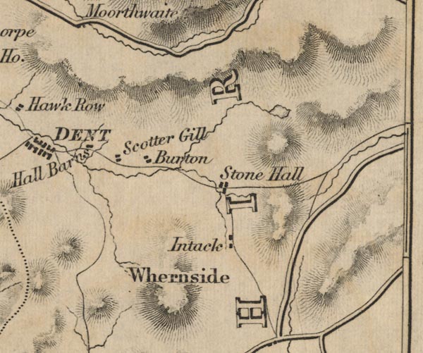 FD02SD78.jpg "Whernside" Hill hachuring. item:- JandMN : 100.1 Image © see bottom of page |
|||||||||||||||||||||
|
|
||||||||||||||||||||||
| evidence:- | old map:- Balderston c1890 map placename:- Whernside |
|||||||||||||||||||||
| source data:- | Map, the hills in the Ingleton area, probably by Robert R
Balderston, engraved by Goodall and Suddick, Leeds, West
Yorkshire, about 1890.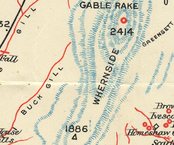 BS1SD78F.jpg "WHERNSIDE / 2414" item:- private collection : 27.1 Image © see bottom of page |
|||||||||||||||||||||
|
|
||||||||||||||||||||||
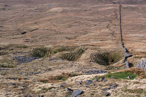 BUG33.jpg shakeholes at, (taken 24.3.2011) |
||||||||||||||||||||||
|
|
||||||||||||||||||||||
Lakes Guides menu.