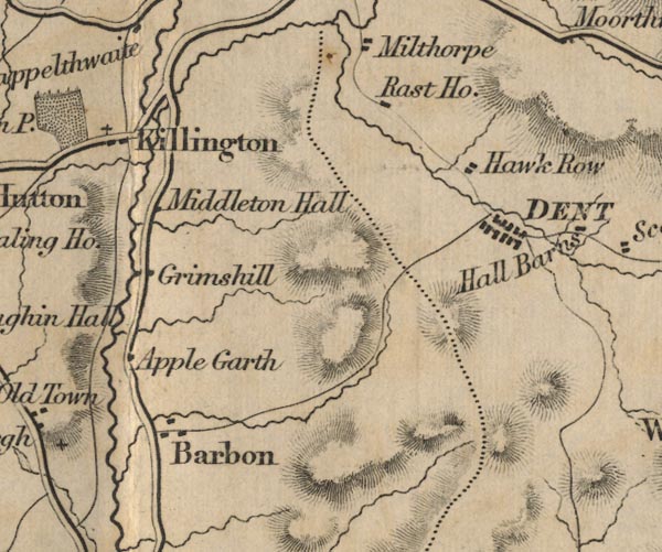
 Ford 1839 map SD68


|

|
|
|
gazetteer links places may or may not be labelled on the map |
||

|
-- Applegarth -- "Apple Garth" |
|
|
|
-- Barbon -- "Barbon" |
|
|
|
-- Dent -- "DENT" |
|
|
|
-- Grimes Hill -- "Grimshill" |
|
|
|
-- Hacra -- "Hawk Row" |
|
|
|
-- Killington -- "Killington" |
|
|
|
-- Middleton Hall -- "Middleton Hall" |
|
|
|
-- Rash -- "Rast Ho." |
|
|
civil parishes The area roughly includes parts of parishes:- Dent Kirkby Lonsdale Casterton Sedbergh Barbon Killington Mansergh Middleton |
||
|
|
||
|
|
Lakes Guides menu. | |