 Old Cumbria Gazetteer
 |
 |
|
| Hacra, Dent | ||
| Hacra | ||
| locality:- | Towns Fell | |
| civil parish:- | Dent (formerly Yorkshire) | |
| county:- | Cumbria | |
| locality type:- | buildings | |
| coordinates:- | SD69528842 | |
| 1Km square:- | SD6988 | |
| 10Km square:- | SD68 | |
|
|
||
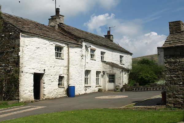 BYK61.jpg (taken 31.5.2013) 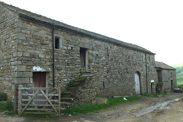 BYK63.jpg Barn. (taken 31.5.2013) |
||
|
|
||
| evidence:- | old map:- OS County Series (Yrk 64 9) placename:- Hacra |
|
| source data:- | Maps, County Series maps of Great Britain, scales 6 and 25
inches to 1 mile, published by the Ordnance Survey, Southampton,
Hampshire, from about 1863 to 1948. |
|
|
|
||
| evidence:- | possibly old map:- Ford 1839 map placename:- Hawk Row |
|
| source data:- | Map, uncoloured engraving, Map of the Lake District of
Cumberland, Westmoreland and Lancashire, scale about 3.5 miles
to 1 inch, published by Charles Thurnam, Carlisle, and by R
Groombridge, 5 Paternoster Row, London, 3rd edn 1843.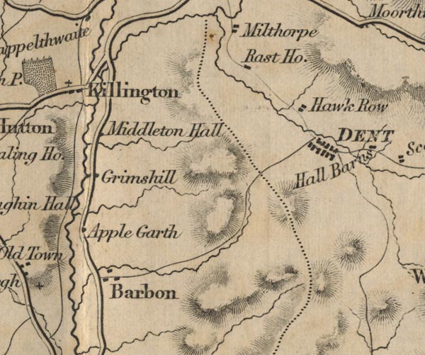 FD02SD68.jpg "Hawk Row" item:- JandMN : 100.1 Image © see bottom of page |
|
|
|
||
| evidence:- | database:- Listed Buildings 2010 placename:- Hacra Farm item:- court cupboard |
|
| source data:- | courtesy of English Heritage "HACRA FARMHOUSE / / / DENT / SOUTH LAKELAND / CUMBRIA / II / 484313 / SD6952888416" |
|
|
|
||
| evidence:- | database:- Listed Buildings 2010 |
|
| source data:- | courtesy of English Heritage "BARN APPROXIMATELY 15 METRES EAST OF HACRA FARMHOUSE / / / DENT / SOUTH LAKELAND / CUMBRIA / II / 484314 / SD6955088392" |
|
|
|
||
 Lakes Guides menu.