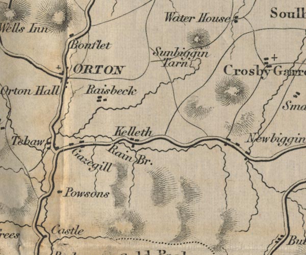
 Ford 1839 map NY60


|

|
|
|
gazetteer links places may or may not be labelled on the map |
||

|
-- Bullflatt -- "Bonflet" |
|
|
|
-- Gaisgill -- "Gazegill" |
|
|
|
-- Kelleth -- "Kelleth" |
|
|
|
-- Newbiggin-on-Lune -- "Newbiggin" |
|
|
|
-- Orton Hall -- "Orton Hall" |
|
|
|
-- Orton -- "ORTON" |
|
|
|
-- Powsons -- "Powsons" |
|
|
|
-- Raisbeck -- "Raisbeck" |
|
|
|
-- Rayne Bridge -- "Rain Br." |
|
|
|
-- Sunbiggin Tarn -- "Sunbiggin Tarn" |
|
|
|
-- Tebay -- "Tebaw" |
|
|
civil parishes The area roughly includes parts of parishes:- Tebay Grayrigg Crosby Ravensworth Orton S Ravenstonedale Asby Crosby Garrett |
||
|
|
||
|
|
Lakes Guides menu. | |