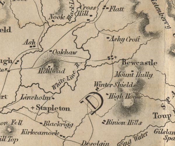
 Ford 1839 map NY57


|

|
|
|
gazetteer links places may or may not be labelled on the map |
||

|
-- Ash -- "Ash" |
|
|
|
-- Ashycroft -- "Ashy Croft" |
|
|
|
-- Bewcastle -- "Bewcastle" |
|
|
|
-- Blackrigg -- "Blackrigg" |
|
|
|
-- High House -- "High House" |
|
|
|
-- Lyneholme -- "Lineholm" |
|
|
|
-- Mount Hulie -- "Mount Hully" |
|
|
|
-- Nook -- "Nook" |
|
|
|
-- Oakshaw -- "Oakhaw" |
|
|
|
-- Rinnion Hills -- "Rinion Hills" |
|
|
|
-- Roadhead -- "Hillhead" |
|
|
|
-- Stapleton -- "Stapleton" |
|
|
|
-- White Lyne -- "White Line R." |
|
|
|
-- Winter Shields -- "Winter Shields" |
|
|
civil parishes The area roughly includes parts of parishes:- Kingwater Stapleton Bewcastle Askerton |
||
|
|
||
|
|
Lakes Guides menu. | |