 Ford 1839 map NY53


|

|
|
|
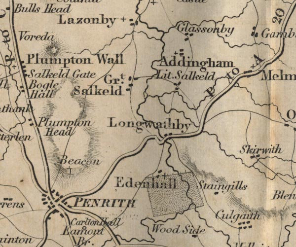
gazetteer links places may or may not be labelled on the map |
||

|
-- Addingham -- "Addingham" |
|
|
|
-- Edenhall -- "Edenhall" |
|
|
|
-- Glassonby -- "Glassonby" |
|
|
|
-- Great Salkeld -- "Gt. Salkeld" |
|
|
|
-- Langwathby -- "Longwathby" |
|
|
|
-- Little Salkeld -- "Lit. Salkeld" |
|
|
|
-- Penrith Beacon -- "Beacon" |
|
|
|
-- Penrith -- "PENRITH" |
|
|
|
-- Appleby to Penrith -- "P to B 20 Ms." |
|
|
|
-- Penrith to Alston -- "P to A 20 Ms." |
|
|
|
-- Penrith to Keswick -- "K to P 18 Ms." |
|
|
|
-- Penrith to Wigton -- "W to P 21 Ms." |
|
|
|
-- Shap to Penrith -- "S to P 11 Ms." |
|
|
|
-- Staingills -- "Staingills" |
|
|
civil parishes The area roughly includes parts of parishes:- Culgaith Penrith Great Salkeld Glassonby Lazonby Hesket Hunsonby Ousby Kirkoswald Langwathby Brougham |
||
|
|
||
|
|
Lakes Guides menu. | |