 Ford 1839 map NY50


|

|
|
|
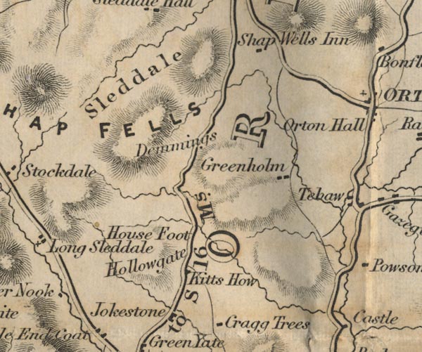
gazetteer links places may or may not be labelled on the map |
||

|
-- Demmings -- "Demmings" |
|
|
|
-- Hause Foot -- "House Foot" |
|
|
|
-- High Greenholme -- "Greenholm" |
|
|
|
-- Hollowgate -- "Hollowgate" |
|
|
|
-- Kids Howe -- "Kitts How" |
|
|
|
-- Low Jock Scar -- "Jokestone" |
|
|
|
-- Kendal to Shap -- "K to S 16 Ms." |
|
|
|
-- Shap Fells -- "SHAP FELLS" |
|
|
|
-- Shap Wells Hotel -- "Shap Wells Inn" |
|
|
|
-- Wet Sleddale -- "Sleddale" |
|
|
civil parishes The area roughly includes parts of parishes:- Shap Rural Whinfell Orton S Tebay Fawcett Forest Longsleddale Grayrigg Strickland Roger Whitwell and Selside Crosby Ravensworth |
||
|
|
||
|
|
Lakes Guides menu. | |