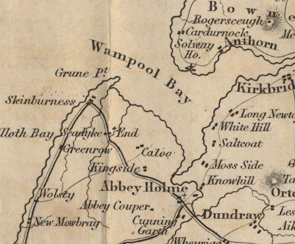
 Ford 1839 map NY15


|

|
|
|
gazetteer links places may or may not be labelled on the map |
||

|
-- Abbey Cowper -- "Abbey Couper" |
|
|
|
-- Abbey Town -- "Abbey Holme" |
|
|
|
-- Anthorn -- "Anthorn" |
|
|
|
-- Calvo -- "Caloo" |
|
|
|
-- Cardurnock -- "Cardurnock" |
|
|
|
-- Cunning Garth -- "Cunning Garth" |
|
|
|
-- Greenrow -- "Greenrow" |
|
|
|
-- Grune Point -- "Grune Pt." |
|
|
|
-- Kingside Hill -- "Kingside" |
|
|
|
-- Knowehill -- "Knowhill" |
|
|
|
-- Moricambe -- "Wampool Bay" |
|
|
|
-- Moss Side -- "Moss Side" |
|
|
|
-- Newton Arlosh -- "Long Newton" |
|
|
|
-- Salt Cotes -- "Saltcoat" |
|
|
|
-- Seadyke End -- "Seadyke End" |
|
|
|
-- Skinburness -- "Skinburness" |
|
|
|
-- Solway House -- "Solway Ho." |
|
|
civil parishes The area roughly includes parts of parishes:- Holme Low Holme St Cuthbert Holme Abbey Holme East Waver Dundraw Silloth-on-Solway |
||
|
|
||
|
|
Lakes Guides menu. | |