 Ford 1839 map NY04


|

|
|
|
gazetteer links places may or may not be labelled on the map |
||

|
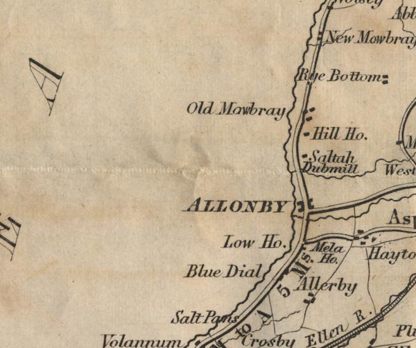
-- Allerby -- "Allerby" |
|
|
|
-- Allonby -- "ALLONBY" |
|
|
|
-- Blue Dial -- "Blue Dial" |
|
|
|
-- Dub Mill -- "Dubmill" |
|
|
|
-- Heather Bank -- "Low Ho." |
|
|
|
-- Hill House -- "Hill Ho." |
|
|
|
-- Mawbray -- "Old Mawbray" |
|
|
|
-- Mealo House -- "Mela Ho." |
|
|
|
-- Newtown -- "New Mawbray" |
|
|
|
-- Maryport to Allonby -- "M to A 5 Ms." |
|
|
|
-- Salta -- "Saltah" |
|
|
civil parishes The area roughly includes parts of parishes:- Hayton and Mealo Allonby Oughterside and Allerby Holme St Cuthbert Crosscanonby |
||
|
|
||
|
|
Lakes Guides menu. | |