 Old Cumbria Gazetteer
 |
 |
|
| Dub Mill, Allonby | ||
| Dub Mill | ||
| locality:- | Dubmill | |
| civil parish:- | Allonby (formerly Cumberland) | |
| civil parish:- | Holme St Cuthbert (formerly Cumberland) | |
| county:- | Cumbria | |
| locality type:- | water mill | |
| locality type:- | mill | |
| locality type:- | corn mill | |
| coordinates:- | NY07844498 | |
| 1Km square:- | NY0744 | |
| 10Km square:- | NY04 | |
| SummaryText:- | Across the stream on the sea shore, below a mill pond; adjoining Seacroft Farm. | |
|
|
||
| evidence:- | old map:- OS County Series (Cmd 27 14) placename:- Dub Mill |
|
| source data:- | Maps, County Series maps of Great Britain, scales 6 and 25
inches to 1 mile, published by the Ordnance Survey, Southampton,
Hampshire, from about 1863 to 1948. Group of buildings and the mill dam, it is not clear which building is the mill. "Dub Mill (Corn) / Mill Dam" |
|
|
|
||
| evidence:- | old map:- Mercator 1595 (edn?) placename:- Dubmil |
|
| source data:- | Map, hand coloured engraving, Northumbria, Cumberlandia, et
Dunelmensis Episcopatus, ie Northumberland, Cumberland and
Durham etc, scale about 6.5 miles to 1 inch, by Gerard Mercator,
Duisberg, Germany, about 1595.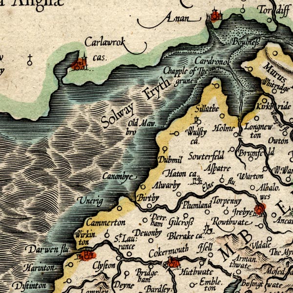 MER8CumB.jpg "Dubmil" circle item:- JandMN : 169 Image © see bottom of page |
|
|
|
||
| evidence:- | possibly old text:- Gents Mag placename:- Dubmill House item:- leading line |
|
| source data:- | Magazine, The Gentleman's Magazine or Monthly Intelligencer or
Historical Chronicle, published by Edward Cave under the
pseudonym Sylvanus Urban, and by other publishers, London,
monthly from 1731 to 1922. goto source goto sourceGentleman's Magazine 1748 p.291 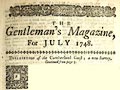 click to enlarge click to enlargeG748E04.jpg "... when Dubmill-house and mount Skiddow are in a line, you are on the tail of Dubmill swap, and so may turn down the Salway; 'tis about half a mile broad." |
|
|
|
||
| evidence:- | old map:- Donald 1774 (Cmd) placename:- Dubmill |
|
| source data:- | Map, hand coloured engraving, 3x2 sheets, The County of Cumberland, scale about 1
inch to 1 mile, by Thomas Donald, engraved and published by Joseph Hodskinson, 29
Arundel Street, Strand, London, 1774.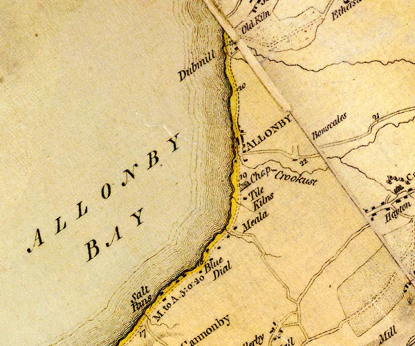 D4NY04SE.jpg "Dubmill" circle with rays, mill wheel; a water mill item:- Carlisle Library : Map 2 Image © Carlisle Library |
|
|
|
||
Lakes Guides menu.