 Crosthwaite 1783-94, tetrad SD39X

|

|
|
|
gazetteer links places may or may not be labelled on the map |
||

|
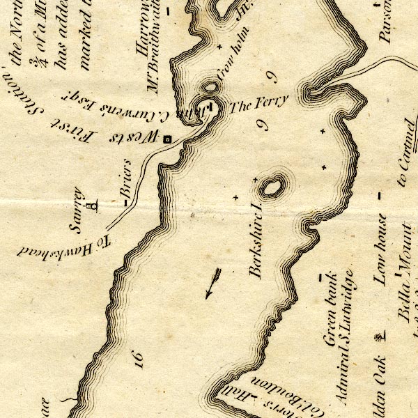
-- Bryers Fold -- "Briers" |
|
|
|
-- Crow Holme -- "Crow holm" |
|
|
|
-- Ferry House, The -- "John C. Curwen's Esqr." |
|
|
|
-- Green Bank -- "Green bank / Admiral S. Lutwidge" |
|
|
|
-- Low House -- "Low house" |
|
|
|
-- Near Sawrey -- "Sawrey" |
|
|
|
-- Ramp Holme -- "Berkshire I." |
|
|
|
-- Hawkshead to Windermere Ferry -- "To Hawkshead" |
|
|
|
-- Windermere Ferry to Windermere -- "To Hawkshead" |
|
|
|
-- Windermere lake -- "Wests First Station," |
|
|
|
-- Windermere Ferry (?) -- "The Ferry" |
|
|
civil parishes The area roughly includes parts of parishes:- Windermere Claife |
||
|
|
||
|
|
Lakes Guides menu. | |