 Burghley 1590 NY47

|

|
|
|
gazetteer links places may or may not be labelled on the map |
||

|
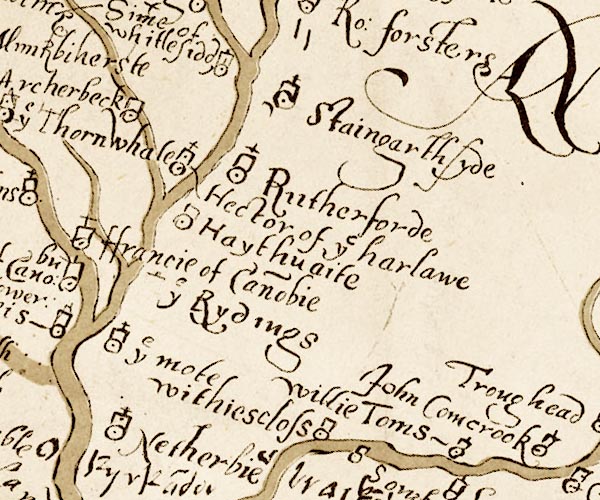
-- CanonbieCanonbie -- "Davy of Cano~bu"--
CanonbieCanonbie -- "ffrancie of Cano~bie" |
|
|
|
-- CumcrookCumcrook -- "Comcrook"-- CumcrookCumcrook --
"John Comcrook" |
|
|
|
-- Haithwaite -- "Haythuaite" |
|
|
|
-- Harelaw -- "Hector of ye harlawe" |
|
|
|
-- Highmoat -- "ye mote" |
|
|
|
-- Netherby -- "Netherbie" |
|
|
|
-- Riddings -- "ye Rydings" |
|
|
|
-- Whiteclose -- "withiescloss" |
|
|
civil parishes The area roughly includes parts of parishes:- Hethersgill Solport Bewcastle Stapleton Kirkandrews Arthuret Nicholforest |
||
|
|
||
|
|
Lakes Guides menu. | |