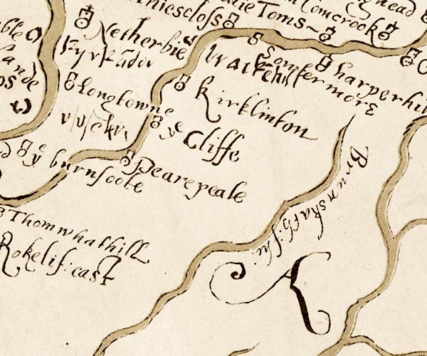
 Burghley 1590 NY46

|

|
|
|
gazetteer links places may or may not be labelled on the map |
||

|
-- Brackenhill Tower -- "bracke~hill" |
|
|
|
-- Brunstock Beck -- "Brunskath flu" |
|
|
|
-- Cliff -- "ye Cliffe" |
|
|
|
-- Harperhill -- "harperhill" |
|
|
|
-- Kirkandrews Tower -- "Kyrka~der" |
|
|
|
-- Kirklinton -- "kirklinton" |
|
|
|
-- Longtown -- "Longtowne" |
|
|
|
-- Soutermoor -- "Sowtermore" |
|
|
civil parishes The area roughly includes parts of parishes:- Irthington Westlinton Arthuret Stanwix Rural Brampton Scaleby Walton Stapleton Kirklinton Middle Hethersgill |
||
|
|
||
|
|
Lakes Guides menu. | |