 Carlisle

|

|
|
|
map type:- James 1868 |
|
|
|
Town plan, Carlisle, Cumberland, proposed boundaries etc,
scale 3 inches to 1 mile, by Colonel Sir Henry James,
printed by the Ordnance Survey, Southampton, Hampshire,
1868.
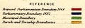
Proposed parliamentary boundary of the borough 1868, with parliamentary boundary 1832, municipal boundary, all roughly coterminus; and parish boundaries. |
||
|
(example private collection (126))
|
||
| map feature:- | table of symbols (boundaries only) & north point & up is N & scale line & rivers & settlements & roads & railways & electoral data & streets | |
| inscription:- |
printed top
CARLISLE |
|
| inscription:- |
printed lower right
Henry James / Colonel Royal Engineers signature |
|
| inscription:- |
printed bottom
Zincographed at the Ordnance Survey Office Southampton under the supervision of Captn. R. M. Parsons F.R.A.S. Col. Sir H. James .R.E =. F.R.S. Ec. Director |
|
| wxh, sheet:- | 25.5x36.5cm | |
| wxh, map:- | 226x329mm | |
| inscription:- |
printed with scale line
Scale Three Inches to One Mile |
|
| scale line:- | 5280+1000 feet = 91.1 mm | |
| scale:- | 1 to 21000 ? (1 to 21011 from scale line) | |

|
||
|
||
| sources:- |
Wordsworth Trust Collection |
|
| items seen (illustrated items in bold):- | ||

|
Dove Cottage : 2009.81.4 -- street map -- Carlisle | |