 Lake District

|

|
|
|
map type:- Garnett 1850s-60s J |
|
|
|
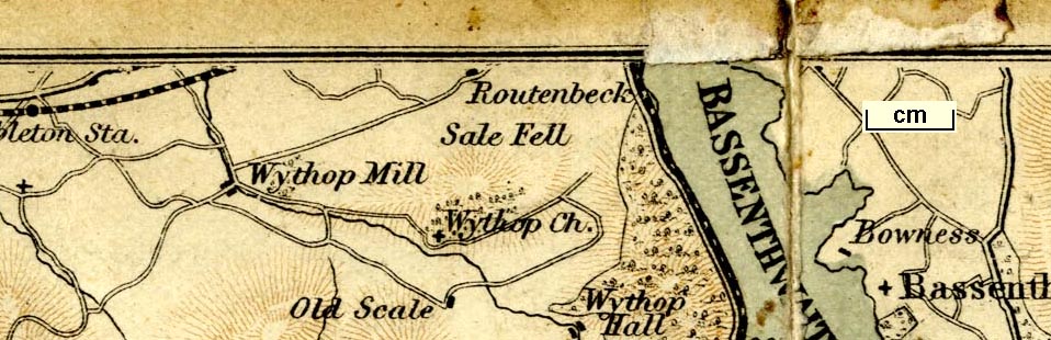
Map, Lake District, scale about 2 miles to 1 inch, by J
Bartholomew, Edinburgh, published by John Garnett,
Windermere, Westmorland, and by Simpkin, Marshall and Co,
London, 1865.
Included, folded in a pocket in the front cover, in the guide book, Ascents and Passes in the Lake District of England, by Herman Prior; the map is two sided. Also found folded in a pocket in the front cover of A Guide to the Lake District of England by Herman Prior, published by John Garnett, Windermere, and Simpkin Marshall and Co, London, 5th edition about 1894? |
||
| see:- | Prior 1865 | |
|
(example JandMN (235_1))
|
||
| map feature:- | folded (3x) & up is N & scale line & rivers & lakes & relief & hill hachuring & woods & trees & forests & parks & settlements & roads & railways | |
| inscription:- |
printed bottom left, right
Windermere; J. Garnett. / J. Bartholomew, Edinr. |
|
| wxh, folded:- | 11x8cm | |
| wxh, sheet:- | 32.5x16cm | |
| wxh, map:- | 318x153mm | |
| inscription:- |
printed with scale line
Miles |
|
| scale line:- | 4 miles = 51.0 mm | |
| scale:- | 1 to 130000 ? (1 to 126223 to from scale line) | |
|
||
| sources:- |
JandMN Collection |
|
| items seen (illustrated items in bold):- | ||

|
JandMN (235_1) -- map -- Lake District | |