 Baines 1829 map

|

|
|
|
map type:- Baines 1829 map |
|
|
|
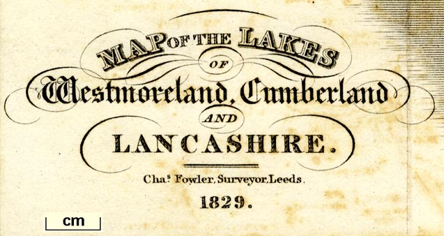
Map of the Lakes of Westmoreland, Cumberland and
Lancashire, scale about 4 miles to 1 inch, by/for Edward
Baines, engraved by W H Lizars, Edinburgh, published by
Hurst, Chance and Co, London et al, 1830.
Tipped in as the frontisiece to a Companion to the Lakes by Edward Baines jnr. The map for the 2nd edn of the guide book is noted in the book's preface:- 'The MAP with which the work is embellished will be found strictly faithful, having been carefully corrected down to the year 1830. It is also engraved with a clearness and distinctness rarely perceived in maps of mountainous countries, which will assist the traveller in consulting it.' |
||
|
(example map Kendal Library (14_1))
|
||
| map feature:- | up is N & scale line & sea plain & coast shaded & coast tinted & rivers & lakes & relief & hill hachuring & table of heights & woods & forests & parks & county & settlements & roads & canals | |
| inscription:- |
printed title
MAP OF THE LAKES / OF / Westmoreland, Cumberland / AND / LANCASHIRE. / 1830. |
|
| inscription:- |
printed bottom left, right, centre
Published by Hurst, Chance & Co. London; John Baines & Co. Leeds, & Wales & Baines, Liverpool. / W. H. Lizars Sculpt. Edinr. / For Baines's 'Companion to the Lakes.' |
|
| inscription:- |
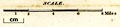
printed above the scale line
SCALE. |
|
| wxh, sheet:- | 27x35cm | |
| wxh, map:- | 241x294mm | |
| scale line:- | 8 miles = 48.9 mm | |
| scale 1 to 260000 ? (1 to 263287 from the scale line assuming a statute mile):- | ||
|
||
| sources:- |
Armitt Library Kendal Library Maps |
|
| items seen (illustrated items in bold):- | ||

|
Armitt Library : A1107.1 -- map -- Map of the Lakes of Westmoreland, Cumberland and Lancashire | |
|
|
Kendal Library : Map 130 -- map -- Map of the Lakes of Westmoreland, Cumberland and Lancashire | |
|
|
Kendal Library (14_1) -- map -- Map of the Lakes of Westmoreland, Cumberland and Lancashire | |