 Murray 1889 map

|

|
|
|
item:- Armitt Library : A1166.5 image:- © see bottom of page |
click to enlarge |
|
|
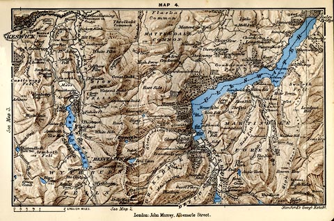
Map, colour printed lithograph, Thirlmere and Ullswater,
Cumberland and Westmorland, scale about 2 miles to 1 inch,
by Stanford's Geographical Establishment from Ordnance
Survey data, published by John Murray, Albemarle Street,
London, edn 1889.
Tipped in opposite p.82 of A Handbook to the English Lakes. |
||

|
Murray 1889 map | |
| map feature:- | up is N & scale line & lat and long grid & rivers & lakes & relief & hill shading & spot heights & woods & settlements & roads & railways | |
| inscription:- |
printed top
MAP 4. |
|
| inscription:- |
printed bottom right, centre
Stanford's Geographical Establishment / London : John Murray, Albemarle Street. |
|
| inscription:- |
printed with scale line
ENGLISH MILES |
|
| scale line:- | 2 miles = 25.3 mm | |
| wxh, sheet:- | 17x11.5cm | |
| wxh, map:- | 157x99mm | |
| scale:- | 1 to 130000 ? (1 to 172221 from scale line) | |