 Stanford 1907

|

|
|
|
item:- JandMN (193_3) image:- © see bottom of page |
click to enlarge |
|
|
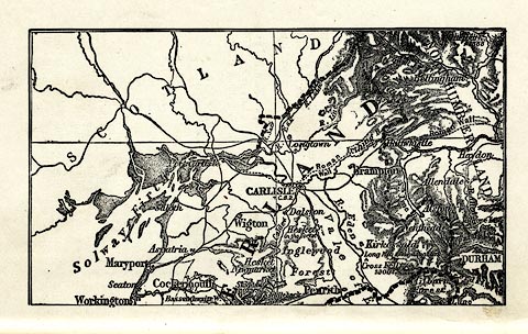
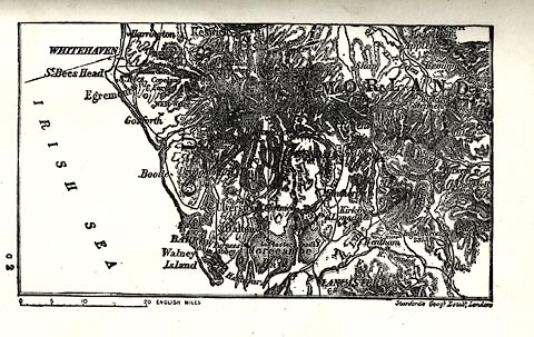
Map, uncoloured lithograph, Cumberland and Westmoreland,
in two plates, scale about 14 miles to 1 inch, by Stanford's
Geographical Establishment, London, 1907?
pp.18-19 in The Counties of England, Ambleside Geography Books series, by Charlotte M Mason, published by Kegan Paul, Trench, Trubner and Co, Broadway House, 68-74 Carter Lane, London, edn 1930. |
||

|
Stanford 1907 | |
| map feature:- | up is N & scale line & lat and long grid & sea plain & coast line & rivers & lakes & relief & hill hachuring (heavy, obscuring much other map detail) & forests & county & settlements & roads | |
| inscription:- |
printed with scale line on south sheet
ENGLISH MILES |
|
| scale line:- | 20 miles = 36.5 mm | |
| wxh, sheet:- | 18.5x12.5cm | |
| wxh, map:- | 138x79mm (approx) | |
| scale:- | 1 to 840000 ? (1 to 881832 from scale line) | |
|
||