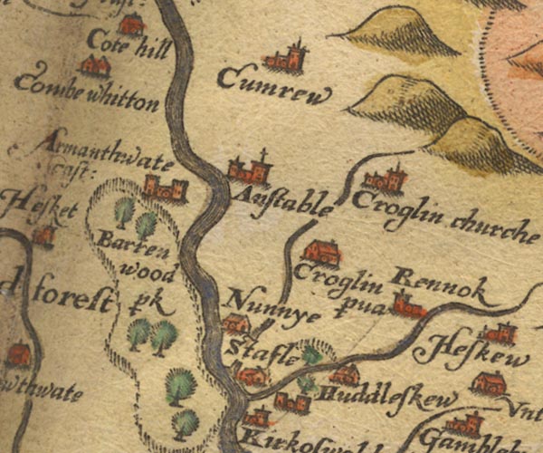
 Saxton 1576 NY54


|

|
|
|
gazetteer links places may or may not be labelled on the map |
||

|
-- Ainstable -- "Anstable" |
|
|
|
-- Armathwaite Place -- "Armathwate cast:" |
|
|
|
-- Baronwood Park -- "barren wood p~k" |
|
|
|
-- Croglin Low Hall -- "Croglin p~va" |
|
|
|
-- Croglin Water |
|
|
|
-- Croglin -- "Croglin churche" |
|
|
|
-- Cumrew -- "Cumrew" |
|
|
|
-- Cumwhitton -- "Combe whitton" |
|
|
|
-- Eden, River -- "Eden flu:" -- "Eden flu:"
-- "Eden flu:" -- "Eden flu:" |
|
|
|
-- Huddlesceugh Hall -- "Huddleskew" |
|
|
|
-- Nunnery -- "Nunnye" |
|
|
|
-- Raven Beck |
|
|
|
-- Renwick -- "Rennok" |
|
|
|
-- St John's Church -- "Croglin churche" |
|
|
|
-- Staffield -- "Stafle" |
|
|
civil parishes The area roughly includes parts of parishes:- Glassonby Lazonby Ainstable Cumwhitton Wetheral Cumrew Kirkoswald Hesket |
||
|
|
||
|
|
Lakes Guides menu. | |