 Saxton 1576 NY47


|

|
|
|
gazetteer links places may or may not be labelled on the map |
||

|
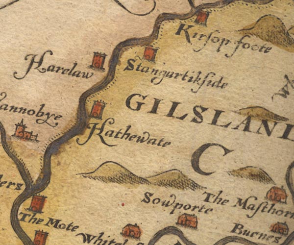
-- Gilsland (?) -- "GILSLAND" |
|
|
|
-- Haithwaite -- "Hathewate" |
|
|
|
-- Harelaw -- "Harelaw" |
|
|
|
-- Liddel Water |
|
|
|
-- Solport -- "Sowporte" |
|
|
|
-- Stonegarthside Hall -- "Stangurtikside" |
|
|
civil parishes The area roughly includes parts of parishes:- Hethersgill Solport Bewcastle Stapleton Kirkandrews Arthuret Nicholforest |
||
|
|
||
|
|
Lakes Guides menu. | |