 Saxton 1576 NY37


|

|
|
|
gazetteer links places may or may not be labelled on the map |
||

|
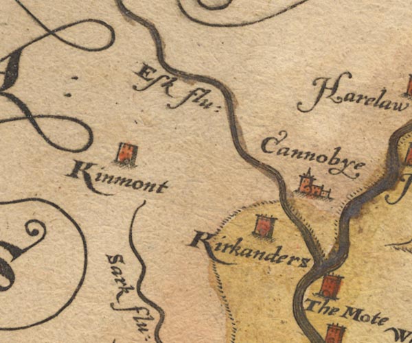
-- Canonbie -- "Cannobye" |
|
|
|
-- Esk, River -- "Esk flu" |
|
|
|
-- Kinmont (?) -- "Kinmont" |
|
|
|
-- Kirkandrews -- "Kirkanders" |
|
|
|
-- Moat -- "The Mote" |
|
|
|
-- Sark, River -- "Sark flu:" |
|
|
civil parishes The area roughly includes parts of parishes:- Arthuret Kirkandrews |
||
|
|
||
|
|
Lakes Guides menu. | |