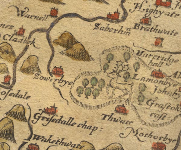
 Saxton 1576 NY33


|

|
|
|
gazetteer links places may or may not be labelled on the map |
||

|
-- Greenthwaite Hall -- "Thwate" |
|
|
|
-- Greystoke Castle -- "Grastok cast:" |
|
|
|
-- Greystoke Forest |
|
|
|
-- Low Braithwaite -- "Brathwate" |
|
|
|
-- Mungrisdale -- "Grisedalle chap:" |
|
|
|
-- Sebergham -- "Saberham" |
|
|
|
-- Sowerby Hall -- "Sowerbye" |
|
|
|
-- St Kentigern's Church -- "Grisedalle chap:" |
|
|
civil parishes The area roughly includes parts of parishes:- Underskiddaw Caldbeck Mungrisdale Castle Sowerby Sebergham Greystoke Skelton |
||
|
|
||
|
|
Lakes Guides menu. | |