 Saxton 1576 NY25


|

|
|
|
gazetteer links places may or may not be labelled on the map |
||

|
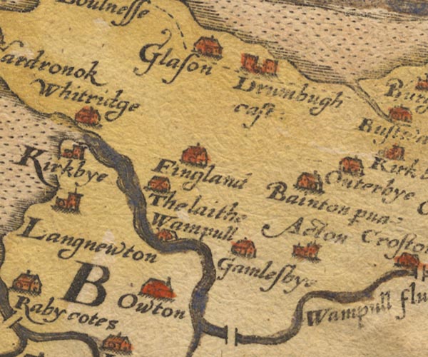
-- Aikton -- "Acton" |
|
|
|
-- Drumburgh Castle -- "Drumbugh cast:" |
|
|
|
-- Fingland -- "Fingland" |
|
|
|
-- Gamelsby -- "Gamlesbye" |
|
|
|
-- Glasson -- "Glason" |
|
|
|
-- Laythes -- "The laithe" |
|
|
|
-- Little Bampton -- "Bainton p~va" |
|
|
|
-- Oughterby -- "Outerbye" |
|
|
|
-- Oulton -- "Owton" |
|
|
|
-- Wampool -- "Wampull" |
|
|
|
-- Wampool, River -- "Wampull flu:" -- "Wampull
flu:" |
|
|
|
-- Whitrigg -- "Whitridge" |
|
|
civil parishes The area roughly includes parts of parishes:- Rockcliffe Aikton Kirkbride Kirkbampton Burgh by Sands Thursby Waverton Woodside Holme East Waver Dundraw |
||
|
|
||
|
|
Lakes Guides menu. | |