 Saxton 1576 NY15


|

|
|
|
gazetteer links places may or may not be labelled on the map |
||

|
-- |
|
|
|
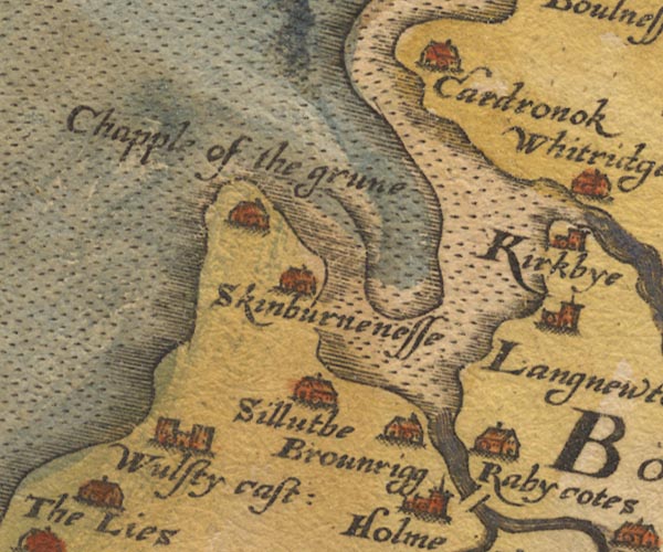
-- Brownrigg -- "Brounrigg" |
|
|
|
-- Cardurnock -- "Cardronok" |
|
|
|
-- -- "Chapple of the grune" |
|
|
|
-- Kirkbride -- "Kirkbye" |
|
|
|
-- Newton Arlosh -- "Langnewton" |
|
|
|
-- Raby Cote -- "Rabycotes" |
|
|
|
-- Silloth -- "Silluthe" |
|
|
|
-- Skinburness -- "Skinburnenesse" |
|
|
|
-- Waver, River |
|
|
|
-- Wolsty Castle (?) -- "Wulsty cast:" |
|
|
civil parishes The area roughly includes parts of parishes:- Holme Low Holme St Cuthbert Holme Abbey Holme East Waver Dundraw Silloth-on-Solway |
||
|
|
||
|
|
Lakes Guides menu. | |