| map place |
identification / evidence |
map square |
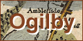
| Ambleside |
Ambleside in Lakes / In mile 13, Westmoreland. labelled Ambleside houses each side of the road and a side street. |
OG96m010.jpg |
| river |
Applethwaite Gill in Underskiddaw / In mile 31, Cumberland. labelled a Rill drawn across the road. |
OG96m030.jpg |
| Winandermere |
Applethwaite in Windermere / In mile 9, Westmoreland. labelled Winandermere houses each side of the road. |
OG96m005.jpg |
| Armanthwate |
Armathwaite Hall in Bassenthwaite / In mile 37, Cumberland. labelled Armanthwate two rows of houses down a turning right off the road. |
OG96m035.jpg |
| fell |
Armboth Fell in St John's Castlerigg and Wythburn / In miles 20 to 27, Cumberland. Mountains on the left of the road for 7 miles. |
OG96m020.jpg |
| hill |
Baneriggs in Lakes / In mile 16, Westmerland. Road ascends and descends a hill. |
OG96m015.jpg |
| Lowbarcus |
Barkhouse in Setmurthy / In mile 38, Cumberland. labelled Lowbarcus a Vill houses each side of the road. |
OG96m035.jpg |
| Basinthwait |
Bassenthwaite / In mile 36, Cumberland. labelled Basinthwait church and houses on the right of the road. |
OG96m035.jpg |
| lake |
Bassenthwaite Lake in Bassenthwaite etc / In miles 35 to 38, Cumberland. Lake on the left of the road for 3 miles. |
OG96m035.jpg |
| river |
Birkside Gill in St John's Castlerigg and Wythburn / In mile 20, Cumberland. labelled a Rill drawn across the road. |
OG96m020.jpg |
| river |
Bleak Beck in Lakes / In mile 10, Westmoreland. labelled a Rill drawn across the road. |
OG96m010.jpg |
| river |
Brathay, River in Skelwith etc / In mile 13, Westmoreland. River alongside off the left of the road, running into lake Windermere. |
OG96m010.jpg |
| bridge |
in Hugill / In mile 6, Westmoreland. Road crosses a river at:- labelled a Stone bridg and brook but no bridge drawn. |
OG96m005.jpg |
| bridge |
in Lakes / In mile 24, Cumberland. Road crosses:- labelled a Stone bridg and brook no bridge drawn. |
OG96m020.jpg |
| bridge |
in Lakes / In mile 15, Westmerland. Road crosses:- labelled a Stone bridg and brook no bridge drawn. |
OG96m015.jpg |
| Broadyate |
Broadgate Farm in Hugill / In mile 7, Westmoreland. labelled Broadyate a Village Houses on the left of the road. |
OG96m005.jpg |
| Basinthwait |
Broadness in Bassenthwaite / In mile 35, Cumberland. labelled Part of Basinthwait houses between the road and the lake on the left of the road. |
OG96m035.jpg |
| Barnside |
Burneside in Strickland Ketel etc / In mile 2, Westmoreland. labelled Barnside houses and church to right of road. |
OG96m000.jpg |
| Birthut Wood |
Burthwaite Wood in Bassenthwaite / In mile 37, Cumberland. labelled Birthut Wood trees on a hill to the right of the road. |
OG96m035.jpg |
| Carlisle |
Carlisle / In mile 35, Cumberland. Turning right:- labelled to Carlisle In mile 39, Cumberland. labelled CARLISLE town plan, town walls with bastions and town gates, rivers on two sides, suburbs. |
OG96m035.jpg |
| hill |
Castlerigg Brow in Keswick / In mile 28, Cumberland. Road descends a hill. |
OG96m025.jpg |
| fell |
Castlerigg Fell in St John's Castlerigg and Wythburn / In miles 20 to 27, Cumberland. Mountains on the left of the road for 7 miles. |
OG96m020.jpg |
| Catherit |
Castlerigg House in Keswick / In mile 28, Cumberland. labelled Cartherit a Vill houses drawn each side of the road. |
OG96m025.jpg |
| church |
in Bassenthwaite / In mile 36, Cumberland. church on the right of the road at:- labelled Basinthwait |
OG96m035.jpg |
| Cole Beck |
/ In mile 37, Cumberland. labelled Cole beck house to the right of the road. |
OG96m035.jpg |
| bridge |
Cocker Bridge in Cockermouth / In mile 43, Cumberland. Road crosses the labelled Coker fluv: in Cockermouth, no bridge drawn. In mile 14, Cumberland. River crossed by a street in Cockermouth, right of the road. |
OG96m040.jpg; OG96Bm10.jpg |
| Coker Fluvius |
Cocker, River in Blindbothel etc / In mile 43, Cumberland. labelled Coker fluv: River crossed by the road in the middle of Cockermouth, tributary to the Derwent, no bridge drawn. In miles 10 to 14, Cumberland. labelled Coker
fluv: river alongside the right of the road for 4 miles. |
OG96m040.jpg; OG96Bm10.jpg |
| Cockermouth |
Cockermouth / In mile 29, Cumberland. Turning left:- labelled to Cockermouth ye worst way In mile 43, Cumberland. labelled Cockermouth street of houses on each side of the road, the castle on the right, and the Rive
r
Cocker flowing under the road to the River Derwent. |
OG96m025.jpg; OG96m040.jpg |
| castle |
/ In mile 43, Cumberland. castle on the right of the road in Cockermouth. In mile 14, Cumberland. labelled ye Cast: a castle beyond the River Cocker, right of the road. |
OG96m040.jpg; OG96Bm10.jpg |
| moor |
Cockermouth Moor in Cockermouth / In mile 42, Cumberland. labelled a Moor on the left of the road. |
OG96m040.jpg |
| bridge |
Crookelty Bridge in Underskiddaw / In mile 31, Cumberland. labelled a Rill drawn across the road, implying no bridge? |
OG96m030.jpg |
| building/s |
Crosses Farm in Windermere / In mile 9, Westmoreland. Houses on the right of the road. |
OG96m005.jpg |
| fell |
Derwent Fells in Above Derwent / In miles 32 to 33, Cumberland. Mountains to the left of the road. |
OG96m030.jpg |
| lake |
Derwent Water in Keswick etc / In mile 29, Cumberland. Drawn as a wide river, narrowing to a river on the left of the road. |
OG96m025.jpg |
| Derwen Fluvius |
Derwent, River in Broughton etc / In mile 29, Cumberland. Flowing from Derwent Water on the left of the road. In miles 30 to 34, Cumberland. labelled Darwen fluv: alongside off to the left of the road, from Keswick to
Bassenthwaite lake. In mile 38, Cumberland. River running out of the lake and crossed by the road over:- labelled Woose bridg of wood In miles 35 to 43, Cumberland. River on the right of the road for 5 miles:- labelled Derwen fluv: |
OG96m025.jpg; OG96m030.jpg; OG96m035.jpg; OG96m040.jpg |
| wood |
Dovenest Wood in Lakes / In mile 12, Westmoreland. Woodland on the right of the road. |
OG96m010.jpg |
| Dunmaile Raise Stones |
Dunmail Raise Stones in St John's Castlerigg and Wythburn / In mile 19, Cumberland. labelled Dunmaile Raise Stones six standing stones on the left of the road. |
OG96m015.jpg |
| hill |
Dunmail Raise in St John's Castlerigg and Wythburn / In mile 18, Westmerland. Road ascends a great hill. |
OG96m015.jpg |
| river |
Dunney Beck in Lakes / In mile 15, Westmerland. River crossed at:- labelled a Stone bridg and brook no bridge drawn. |
OG96m015.jpg |
| common |
Embleton High Common in Embleton / In miles 39 to 41, Cumberland. labelled Mountainous labelling what could be a mountain profile to the left of the road. |
OG96m035.jpg; OG96m040.jpg |
| river |
Fisherplace Gill in St John's Castlerigg and Wythburn / In mile 24, Cumberland. labelled a Rill drawn across the road. |
OG96m020.jpg |
| bridge |
Gowan Bridge in Over Staveley etc / In mile 5, Westmoreland. Road crosses:- labelled a Stone bridg and brook no bridge drawn, at the edge of Staveley. |
OG96m005.jpg |
| river |
Gowan, River in Hugill / In mile 5, Westmoreland. labelled a Stone bridg and brook crossed by the road, no bridge drawn, at the edge of Staveley. In mile 6, Westmoreland. River crossed by the road, no bridge drawn, at:- la
belled
a Stone bridg and brook |
OG96m005.jpg; OG96m005.jpg |
| Gresmere |
Grasmere in Lakes / In mile 16, Westmerland. labelled Gresmere a church on the left of the road. |
OG96m015.jpg |
| common |
Grasmere Common in Lakes / In miles 17 to 20, Westmerland. A range of mountains alongside the road on the right for several miles. |
OG96m015.jpg; OG96m020.jpg |
| Grosgate |
Grassgarth in Hugill / In mile 7, Westmoreland. labelled Grosgate a Village Houses off the road to the right. |
OG96m005.jpg |
| Crosthwait |
Great Crosthwaite in Keswick / In mile 30, Cumberland. labelled Crosthwait church off the road to the left. |
OG96m030.jpg |
| river |
Greenhead Gill in Lakes / In mile 17, Westmerland. River crossed at:- labelled a Stone bridg and brook no bridge drawn. |
OG96m015.jpg |
| bridge |
Greta Bridge in Keswick / In mile 29, Cumberland. labelled a Wood bridg over labelled Thurlmire fluv: No bridge drawn. |
OG96m025.jpg |
| Thurlmire Fluvius |
Greta, River in Keswick etc / In mile 29, Cumberland. labelled Thurlmire fluv: alongside the right of the road then crossing under:- labelled a Wood bridg no bridge drawn; tributary to the River Derwent. |
OG96m025.jpg |
| river |
Hall Beck in Bassenthwaite / In mile 36, Cumberland. River crossed at:- labelled a Wood bridg & brook no bridge drawn. |
OG96m035.jpg |
| hill |
Helvellyn in St John's Castlerigg and Wythburn etc / In miles 20 to 24, Cumberland. Range of mountain on the right of the road for 4 miles. |
OG96m020.jpg |
| wood |
High Hag Wood in Windermere / In mile 9, Westmoreland. Woodland on the left of the road. |
OG96m005.jpg |
| Cust |
High Nest in St John's Castlerigg and Wythburn / In mile 28, Cumberland. labelled Cust houses each side of the road. |
OG96m025.jpg |
| river |
Holbeck in Lakes / In mile 11, Westmoreland. River crossed at:- labelled a Stone bridg and brook no bridge drawn. |
OG96m010.jpg |
| bridge |
Holbeck Bridge in Lakes / In mile 11, Westmoreland. Road crosses:- labelled a Stone bridg and brook no bridge drawn. |
OG96m010.jpg |
| building/s |
Holbeck Ghyll in Lakes / In mile 11, Westmoreland. House drawn on the right of the road, on the bank of a river |
OG96m010.jpg |
| river |
How Beck in St John's Castlerigg and Wythburn / In mile 24, Cumberland. River crossed at:- labelled a Stone bridg and brook no bridge drawn. |
OG96m020.jpg |
| Inges |
Ings in Hugill / In mile 6, Westmoreland. Houses on the right of the road, and a church:- labelled Chapel on the Inges |
OG96m005.jpg |
| Ireby |
Ireby / In mile 36, Cumberland. Turning right:- labelled to Ireby In mile 43, Cumberland. Turning right:- labelled to Ireby In mile 22, Cumberland. Turning right:- labelled to Ireby |
OG96m035.jpg; OG96m040.jpg; OG96Bm20.jpg |
| Kendal |
Kendal / In mile 0, Westmoreland. labelled Kendal town plan, castle, river; Ogilby's route leaves at the end of Stricklandgate. |
OG96m000.jpg |
| castle |
Kendal Castle in Kendal / In mile 0, Westmoreland. labelled ye Castle castle walls around the castle building. |
OG96m000.jpg |
| river |
Kent, River in Kentmere etc / In mile 0, Westmoreland. River through the town. |
OG96m000.jpg |
| Keswick |
Keswick / In mile 29, Cumberland. labelled Keswick town plan with houses, a river at the further end. In mile 6, Cumberland. Turning right:- labelled to Keswick |
OG96m025.jpg; OG96Bm05.jpg |
| river |
Lair Beck in Underskiddaw / In mile 30, Cumberland. labelled a Rill drawn across the road; tributary to the River Derwent. |
OG96m030.jpg |
| Little Crosthwait |
Little Crosthwaite in Underskiddaw / In mile 33, Cumberland. labelled Little Crosthwait houses each side of the road. |
OG96m030.jpg |
| fell |
Loughrigg Fell in Lakes / In mile 14, Westmerland. Mountains on the left and right of the road. |
OG96m010.jpg |
| Cust |
Low Nest in St John's Castlerigg and Wythburn / In mile 28, Cumberland. labelled Cust houses each side of the road. |
OG96m025.jpg |
| Lawfeild |
Lowfield in Setmurthy / In mile 39, Cumberland. labelled Lawfeild a Vill houses on the right of the road. |
OG96m035.jpg |
| river |
Mill Beck in Underskiddaw / In mile 31, Cumberland. labelled a Rill drawn across the road. |
OG96m030.jpg |
| bridge |
Mill Bridge in Lakes / In mile 17, Westmerland. Road crosses:- labelled a Stone bridg and brook no bridge drawn. |
OG96m015.jpg |
| water mill |
in Windermere / In mile 10, Westmoreland. labelled a Watermill House on the right of the road, on the bank of a river. |
OG96m010.jpg |
| Milbeck Hall |
in Underskiddaw / In mile 31, Cumberland. labelled Milbeck Hall large house on the right of the road. |
OG96m030.jpg |
| Milbeck |
Millbeck in Underskiddaw / In mile 30, Cumberland. Turning right:- labelled to Milbeck |
OG96m030.jpg |
| river |
Mint, River in Kendal etc / In mile 0, Westmoreland. River drawn as if it were a continuation of the River Kent:- labelled L[ ]t fluv |
OG96m000.jpg |
| Basinthwait |
Mirehouse in Bassenthwaite / In mile 33, Cumberland. labelled Part of Basinthwait houses between the road and the river on the left. |
OG96m030.jpg |
| road |
Mislet Brow in Windermere / In mile 8, Westmoreland. Road ascends a big hill and descends less. |
OG96m005.jpg |
| river |
Naddle Beck in St John's Castlerigg and Wythburn / In mile 26, Cumberland. River crossed at:- labelled a Stone bridg and brook no bridge drawn. |
OG96m025.jpg |
| hill |
Nest Brow in St John's Castlerigg and Wythburn / In mile 27, Cumberland. Road ascends a hill. |
OG96m025.jpg |
| bridge |
North Row Bridge in Bassenthwaite / In mile 36, Cumberland. Road crosses:- labelled a Wood bridg & brook no bridge drawn. |
OG96m035.jpg |
| building/s |
Ormathwaite Hall in Underskiddaw / In mile 30, Cumberland. House off the road to the right. |
OG96m030.jpg |
| Woose Bridge |
Ouse Bridge in Blindcrake / In mile 38, Cumberland. Road crosses:- labelled Woose bridg of wood over the river running out of the lake. |
OG96m035.jpg |
| Penreth |
Penrith / In mile 30, Cumberland. Turning right:- labelled to Penreth |
OG96m030.jpg |
| Penrith |
Penrith / In mile 9, Westmoreland. Crossroads, right:- labelled to Penrith |
OG96m005.jpg |
| wood |
Pull Woods in Skelwith / In mile 12, Westmoreland. Wooded hill beyond the lake, left of the road. |
OG96m010.jpg |
| route segment |
in Kendal etc / In the road from Kendal to Cockermouth. |
OG96m000.jpg |
| route segment |
in Nether Staveley etc / In the road from Kendal to Cockermouth. |
OG96m005.jpg |
| route segment |
in Windermere etc / In the road from Kendal to Cockermouth. |
OG96m010.jpg |
| route segment |
in Lakes etc / In the road from Kendal to Cockermouth. |
OG96m015.jpg |
| route segment |
in St John's Castlerigg and Wythburn / In the road from Kendal to Cockermouth. |
OG96m020.jpg |
| route segment |
in St John's Castlerigg and Wythburn etc / In the road from Kendal to Cockermouth. |
OG96m025.jpg |
| route segment |
in Keswick etc / In the road from Kendal to Cockermouth. |
OG96m030.jpg |
| route segment |
in Bassenthwaite etc / In the road from Kendal to Cockermouth. |
OG96m035.jpg |
| route segment |
in Setmurthy etc / In the road from Kendal to Cockermouth. |
OG96m040.jpg |
| river |
Raise Beck in Lakes / In mile 19, Westmerland, Cumberland. River crossed at:- labelled a Stone bridg and brook no bridge drawn; the county boundary:- labelled Enter Cumberland a dotted line, along the river. |
OG96m015.jpg |
| bridge |
Raise Bridge in Lakes / In mile 19, Westmerland, Cumberland. Road crosses:- labelled a Stone bridg and brook no bridge drawn. |
OG96m015.jpg |
| river |
Ratherheath Beck in Strickland Ketel / In mile 3, Westmoreland. labelled a Rill drawn across the road. |
OG96m000.jpg |
| Caston |
Reston in Hugill / In mile 6, Westmoreland. labelled Caston Houses on the right of the road. |
OG96m005.jpg |
| road |
Keswick to Cockermouth in Keswick etc / In mile 29, Cumberland. Turning left:- labelled to Cockermouth ye worst way |
OG96m025.jpg |
| road |
Penrith to Keswick in Penrith etc / In mile 30, Cumberland. Turning right:- labelled to Penreth |
OG96m030.jpg |
| river |
Rothay, River in Lakes / In mile 13, Westmoreland. River alongside off the left of the road, running into lake Windermere. In mile 14, Westmerland. River alongside the road on the left, running out of Rydal Water. |
OG96m010.jpg |
| bridge |
Rough How Bridge in Lakes / In mile 26, Cumberland. Road crosses:- labelled a Stone bridg and brook no bridge drawn. |
OG96m025.jpg |
| river |
Rydal Beck in Lakes / In mile 14, Westmerland. River crosses under the road, joins the River Rothay? no bridge drawn. |
OG96m010.jpg |
| fell |
Rydal Fell in Lakes / In miles 14 to 17, Westmerland. Mountains on the right of the road. |
OG96m015.jpg |
| Ridale Hall |
Rydal Hall in Lakes / In mile 14, Westmerland. labelled Ridale hall house up a turning right of the road. |
OG96m010.jpg |
| building/s |
Rydal Old Hall in Lakes / In mile 13, Westmoreland. labelled the Hall large house on the left of the road. |
OG96m010.jpg |
| Ridale Park |
Rydal Park in Lakes / In mile 14, Westmerland. The road goes through:- labelled Ridale Park a paling fence, and trees. |
OG96m010.jpg |
| lake |
Rydal Water in Lakes / In mile 15, Westmerland. Lake close on the left of the road. |
OG96m015.jpg |
| Ridale |
Rydal in Lakes / In mile 14, Westmerland. labelled Ridale houses each side of the road. |
OG96m010.jpg |
| river |
Scandale Beck in Lakes / In mile 14, Westmerland. River drawn across the road, in Rydal Park. |
OG96m010.jpg |
| bridge |
Scandale Bridge in Lakes / In mile 14, Westmerland. River drawn across the road, in Rydal Park. |
OG96m010.jpg |
| fell |
Scandale Fell in Lakes / In mile 14, Westmerland. Mountains on the right of the road. |
OG96m010.jpg |
| Scarwell |
Scarness in Bassenthwaite / In mile 35, Cumberland. Turning left:- labelled to Scarwell |
OG96m035.jpg |
| wood |
Setmurthy Common in Setmurthy / In miles 39 and 40, Cumberland. Road ascends and descends a large hill. labelled Mountainous labelling the area right of the road. |
OG96m035.jpg; OG96m040.jpg |
| wood |
Skelghyll Wood in Lakes / In mile 12, Westmoreland. Woodland on the right of the road. |
OG96m010.jpg |
| Smathods Bridge |
Smaithwaite Bridge in St John's Castlerigg and Wythburn / In mile 25, Cumberland. labelled Smathods bridg over Thurlemire fluv: the road crossing the river, no bridge drawn. |
OG96m025.jpg |
| bridge |
Smithy Bridge in Lakes / In mile 17, Westmerland. Road crosses:- labelled a Stone bridg and brook no bridge drawn. |
OG96m015.jpg |
| smithy |
in Keswick / In mile 30, Cumberland. labelled a Smiths shop house at the turning to Penrith, on the right of the road. |
OG96m030.jpg |
| smithy |
in Lakes / In mile 18, Westmerland. labelled a Smithshop house drawn on the right of the road. |
OG96m015.jpg |
| Chapel on the Inges |
St Anne's Church in Hugill / In mile 6, Westmoreland. labelled Chapel on the Inges drawn on the right of the road, by houses. |
OG96m005.jpg |
| hill |
St Catherine's Brow in Windermere / In mile 8, Westmoreland. Descend a hill. |
OG96m005.jpg |
| Thurlemire Fluvius |
St John's Beck in St John's Castlerigg and Wythburn / In mile 25, Cumberland. labelled Smathods bridg over Thurlemire fluv: river crossed by the road, no bridge drawn. |
OG96m025.jpg |
| St Johns |
St John's in the Vale in St John's Castlerigg and Wythburn / In mile 27, Cumberland. Turning, forks back right:- labelled to St. Johns |
OG96m025.jpg |
| church |
St Kentigern's Church in Keswick / In mile 30, Cumberland. church off the road to the left at:- labelled Crosthwait |
OG96m030.jpg |
| church |
St Margaret's Tower in Over Staveley / In mile 5, Westmoreland. Church on the right of the road at:- labelled Stanlay |
OG96m005.jpg |
| church |
St Oswald's Church in Strickland Ketel / In mile 2, Westmoreland. Church to the right of the road at:- labelled Barnside |
OG96m000.jpg |
| church |
St Oswald's Church in Lakes / In mile 16, Westmerland. A church on the left of the road at:- labelled Gresmere |
OG96m015.jpg |
| building/s |
Stanah in St John's Castlerigg and Wythburn / In mile 24, Cumberland. House on the right of the road, on the bank of a river. |
OG96m020.jpg |
| Stanlay |
Staveley in Over Staveley etc / In mile 5, Westmoreland. labelled Stanlay church on the right of the road, and street of houses with gardens behind, each side of the road. |
OG96m005.jpg |
| Grismeere Hill |
Steel Fell in St John's Castlerigg and Wythburn / In mile 19, Westmerland. labelled Grismeere Hill mountain on the left of the road. |
OG96m015.jpg |
| river |
Stock Ghyll in Lakes / In mile 13, Westmoreland. River left of the road, perhaps tributary to the River Rothay. |
OG96m010.jpg |
| river |
Sty Beck in St John's Castlerigg and Wythburn / In mile 24, Cumberland. labelled a Rill drawn across the road. |
OG96m020.jpg |
| Wibourn Water |
Thirlmere in St John's Castlerigg and Wythburn / In miles 22 and 23, Cumberland. labelled Wibourn Water lake close on the left of the road for a mile and a half. |
OG96m020.jpg |
| Thurlspot |
Thirlspot in St John's Castlerigg and Wythburn / In mile 23, Cumberland. labelled Thurlspot houses on the right of the road. |
OG96m020.jpg |
| river |
Tongue Gill in Lakes / In mile 17, Westmerland. River crossed at:- labelled a Stone bridg and brook no bridge drawn. |
OG96m015.jpg |
| river |
Trout Beck in Lakes / In mile 10, Westmoreland. Road crosses:- labelled a Stone bridg and brook no bridge drawn. |
OG96m010.jpg |
| bridge |
Troutbeck Bridge in Windermere / In mile 10, Westmoreland. River crossed by:- labelled a Stone bridg and brook no bridge drawn. |
OG96m010.jpg |
| hill |
Watch Hill in Setmurthy / In mile 42, Cumberland. labelled Hilly on the right of the road, and perhaps a drawing of a hill profile? |
OG96m040.jpg |
| building/s |
Waterhead in Lakes / In mile 12, Westmoreland. Two houses, one each side of the road. |
OG96m010.jpg |
| river |
Whelpside Gill in St John's Castlerigg and Wythburn / In mile 20, Cumberland. labelled a Rill crossing over the road. |
OG96m020.jpg |
| Winandermere |
Windermere in Lakes etc / In miles 10 to 13, Westmoreland. labelled Winandermere vulgo Windermere water alongside the road, on the left for 3 miles. |
OG96m010.jpg |
| Windermere Water |
Windermere in Lakes etc / In miles 10 to 13, Westmoreland. labelled Winandermere vulgo Windermere water alongside the road, on the left for 3 miles. |
OG96m010.jpg |
| Wyborn Chapel |
Wythburn Chapel in St John's Castlerigg and Wythburn / In mile 20, Cumberland. labelled Wyborn Chap: church on the right of the road. |
OG96m020.jpg |
| hill |
Wythburn Fells in St John's Castlerigg and Wythburn / In miles 20 to 27, Cumberland. Mountains on the left of the road for 7 miles. |
OG96m020.jpg |
| Wybourn |
Wythburn in St John's Castlerigg and Wythburn / In mile 21, Cumberland. labelled Wybourn houses on the left of the road. |
OG96m020.jpg |
| hill |
Wythop Brows in Wythop / In miles 35 to 38, Cumberland. Mountains beyond the lake on the left of the road for 3 miles. |
OG96m035.jpg |