 Ogilby 1675, plate 62
 |
 |
|
|
Places Identified
Strip map, road map, the Road from Carlisle to Barwick, scale about 1 inch to 1 mile, by John Ogilby, London, 1675. NB: each image includes an overlap, places in the overlap are not listed. The images are roughly 5 mile segments and are listed from finish to start. | ||
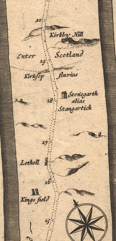 OG62m015.jpg
 |
bridge, Kershopefoot -- bridge -- NY483828
Carby Hill -- earthwork -- NY490843 ? Kershope Burn -- river -- boundary -- NY5184 (etc etc) Kingfield -- locality -- NY4577 ? Liddel -- locality -- NY4679 ? Stonegarthside Hall -- building/s -- NY480819 ? | |
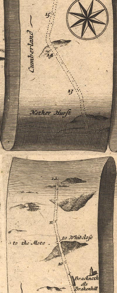 OG62m010.jpg
 |
Hemplands -- bridge -- NY450722
Moat, Kirkandrews Netherhirst -- building/s -- NY447732 Rae Burn -- river -- NY4571 & NY4675 (etc) Whiteclose -- building/s -- NY467709 | |
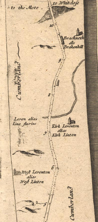 OG62m005.jpg
 |
Brackenhill Tower -- tower -- NY445694 ? ?
Broomhills -- building/s -- NY429683 Kirklinton -- building/s -- NY432670 Lyne, River -- river etc -- NY3765 (etc) St Cuthbert's Church -- church -- NY43266702 Westlinton -- building/s -- NY393645 Woodhead Ford -- ford -- NY427671 ? | |
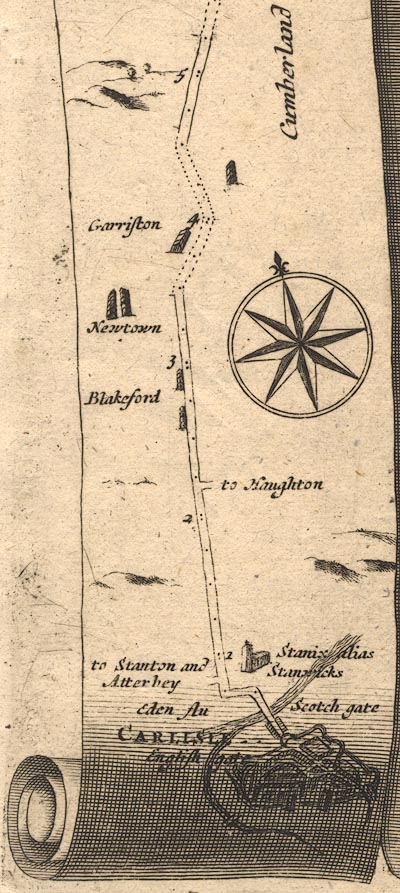 OG62m000.jpg
 |
Blackford -- building/s -- NY397620
Carlisle -- building/s -- roman site -- NY403558 Eden Bridge -- bridge -- NY400565 Eden, River -- river etc -- NY3658 (etc) Etterby -- building/s -- NY389573 Houghton -- building/s -- NY4059 Irish Gate -- town gate -- NY4055 (?) Jerriestown -- building/s -- NY398632 Newtown of Rockcliffe -- building/s -- NY390625 Rickergate -- locality -- NY4056 Scottish Gate -- town gate -- NY45 ? St Michael's Church -- church -- NY40125703 Stainton -- building/s -- NY380569 Stanwix -- building/s -- NY3957 | |
 Lakes Guides menu.