item:-
Armitt Library : 2008.14.111
image:-
©
see bottom of page
WL11.jpg
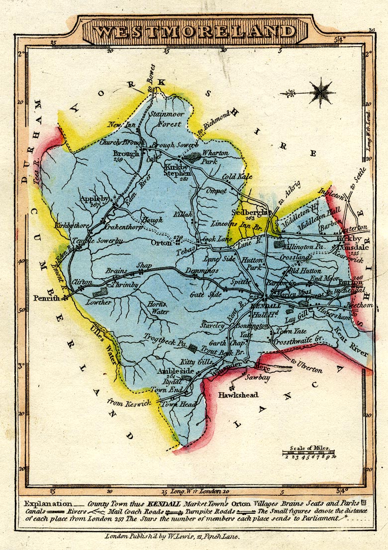
Road map, hand coloured engraving, Westmoreland, scale about 19 miles to 1 inch, by James Wallis, 1810, published by W Lewis, 21 Finch Lane, London, 1819.
Lakes Guides menu.
 Lakes Guides menu.