item:- Armitt Library : A1204.2
image:- © see bottom of page
 TAT1M1.jpg
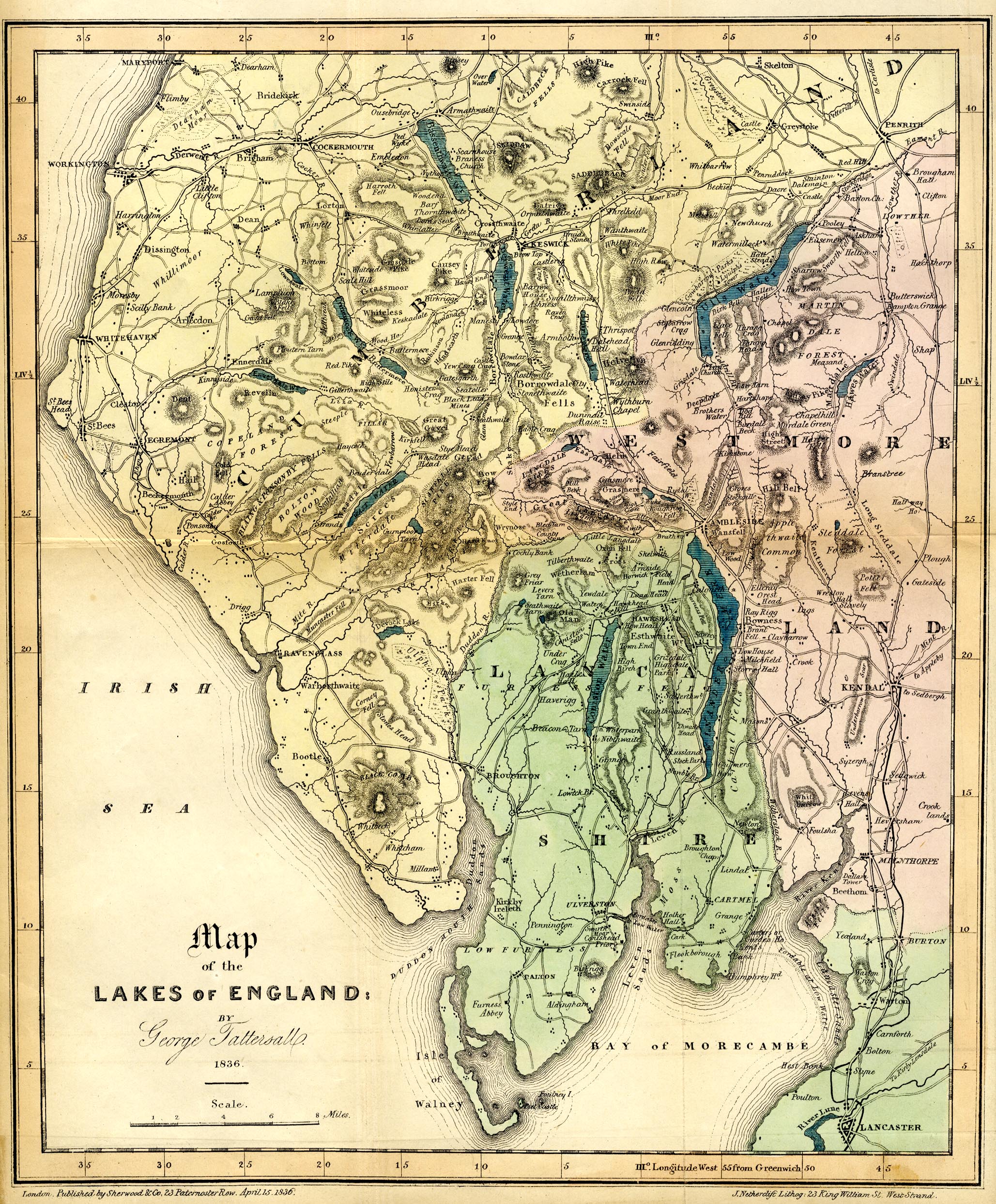
Map, coloured lithograph, Map of the Lakes of England, scale
about 4 miles to 1 inch, by George Tattersall, engraved by J
Nethercliff, 23 King William Street, Strand, published by
Sherwood and Co, 23 Paternoster Row, London, about 1836.
 Lakes Guides menu.