item:- Armitt Library : 2008.14.97
image:- © see bottom of page
 SIM6.jpg
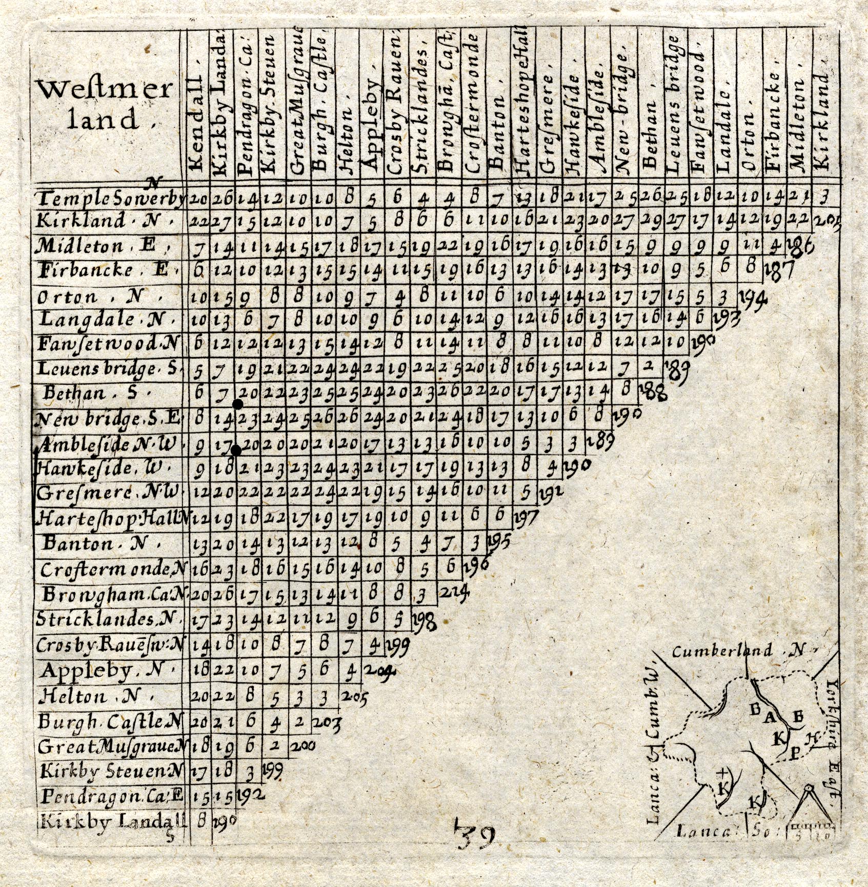
Table of distances, uncoloured engraving, Westmerland ie
Westmorland, with a thumbnail map, scale about 42 miles to 1
inch, by Mathew Simons, published in A Direction for the English
Traviller, 1635.
 Lakes Guides menu.