 Grose 1772-87

|

|
|

|
back to object record | |
| MAP FEATURES | ||
|
|
||
| title cartouche |
Printed upper left in a plain cartouche, rounded ends,
is:-
WESTMORLAND. Printed as the heading to the descriptive text below the map:- WESTMORELAND |
|
|
|
||
|
orientation
labelled borders |
The orientation of the map is indicated by labelled
borders, an outofdate style by the time this map was
published for Grose. The borders read:-
North / East/ South / West The map is printed with North at the top of the sheet. |
|
|
|
||
|
scale line
scale |
Printed lower left is a scale line of:-
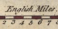
English Miles chequered and labelled in miles. The 10 miles = 30.9 mm gives a scale 1 to 520823 assuming, probably incorrectly, a statue mile. The map scale is about:- 1 to 520000 8 miles to 1 inch |
|
|
|
||
|
sea area
sea plain |
The small area of sea shown off the Cumberland coast is
plain, not tinted.
|
|
|
|
||
|
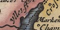
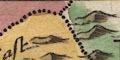
coast line
coast shaded coast form lines foreshore sands |
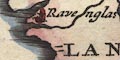
The coast line off Cumberland is emphasised by shading and tinted blue. The shading is continued into estuaries at Ravenglass. But, the coast lines of the Duddon, Leven, and Kent Estuaries have form lines. The shallows off the Cartmel peninsula are engraved with a mixture of moire effect and ?tussock symbols, labelled:- 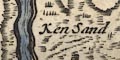
Ken Sand There is a similar foreshore shown in the Duddon Estuary. |
|
|
|
||
|
rivers
bridges |
Rivers are drawn by wiggly line tapering upstream. The broad streams from Coniston Water and lake Windermere are double lines with form or stream lines. Some rivers are labelled, eg:- Dudden flud Spud fl. [River Sprint] Lane fl [River Lune] Baroow fl [Burrow Beck] The major rivers and some tributaries are shown. Notice the implication that fl. is an abbreviation for flud, ie flood? not Latin flumen. Bridges are drawn by a double line across a stream, the stream might be interrupted or continue where it was already engraved. (Roads are not shown on this map). Bridges are not labelled. |
|
|
|
||
| lakes |
Lakes are drawn in outline, shore line shaded, tinted blue. Some are labelled:- Ulles fl Wynander mere others can be recognised, but not very well:- Esthwaite Water Brothers Water Grasmere + Rydal Water (combined, and labelled 'flud') And there are lakes in adjacent Cumberland. |
|
|
|
||
|
relief
hillocks |
Relief is indicated by hillocks shaded to the east, tinted brown. These are mostly scattered and unhelpful, mostly small and unlabelled. Some are larger and might be labelled, eg:- 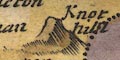
Knot hill [Farleton Knot] Morton pike [Murton Pike] |
|
|
|
||
|
woods
trees forests |
There are some groups of tree symbols, which might be
tinted green. There is at least on label:-
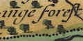
Mallerstange forest |
|
|
|
||
| county |
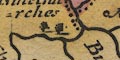
County boundaries are a dotted line. Westmorland has a yellow tint along the boundary, and a paler tint all over the county area. Adjacent counties are tinted along their boundary; Cumberland magenta, Yorkshire green, Lancashire purple. The adjacent counties are labelled, eg:- PART OF CUMBERLAND LANCA SHIRE Some relief, woodland, rivers, and a few settlements are shown outwith the county. |
|
|
|
||
| settlements |
Settlements are marked by a circle with added elements,
and differentiated by style of labelling.
|
|
| towns |
circle, buildings, tower; labelled in upright lowercase
text, eg:-
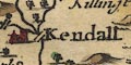
Kendall Appleby The latter, the de jure county town, has a cross on the tower. |
|
|
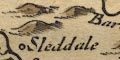
villages
hamlets |
circle; labelled in italic lowercase text, eg:-
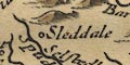
Sleddale Striklandes Watland [Natland] Witherslak Note that Longsleddale is not a nucleated settlement; and Great and Little Strickland are separate villages. |
|
| castles |
Some castles are marked by a circle, labelled, eg:-
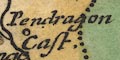
Howgill Cast Pendragon Cast |
|
|
|
||
| miscellaneous | ||
|
|
||
| stones |
Two ?towers tinted red are labelled:-
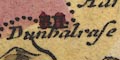
Dunhalrase stones |
|
Lakes Guides menu.