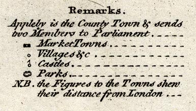
Maps, Bowles's Reduced Map of Westmoreland, scale about 7.5 miles to 1 inch, and of Cumberland? by Carington Bowles, 69 St Paul's Churchyard, London, 1785. (Bowles 1785)
Lakes Guides menu.
 Lakes Guides menu.