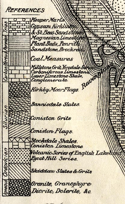
Geological Map of the English Lake District, scale about 5 miles to 1 inch, by John Postlethwaite, 1877. (Postlethwaite 1877 map 1)
Lakes Guides menu.
 Lakes Guides menu.