 Penn 1730s

|

|
|

|
back to object record | |
| Notes about Penn's S West Prospect of Thurston Water, 1730s | ||
|
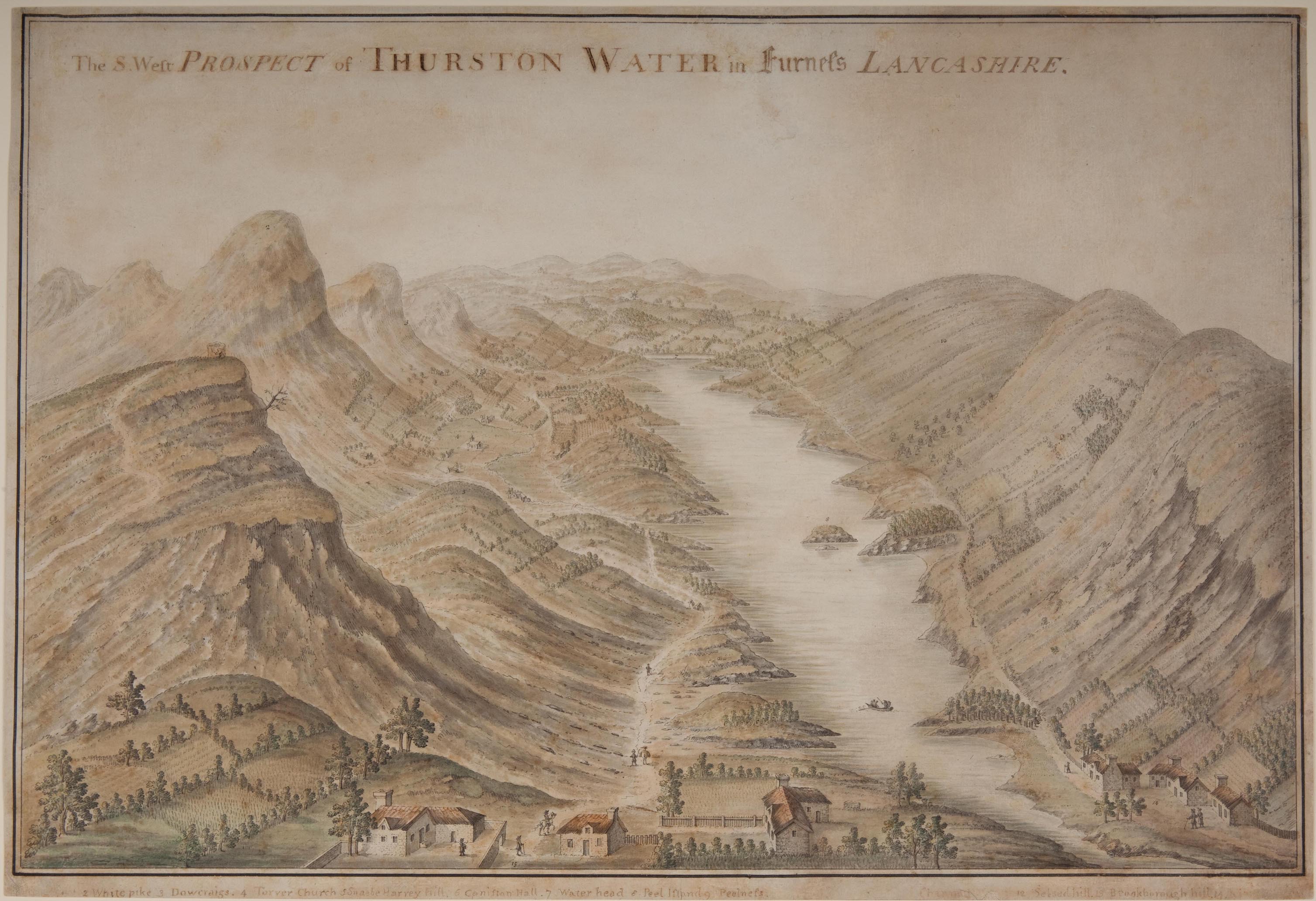
These notes are about the watercolour painting, S West
Prospect of Thurston Water in Furness Lancashire, by Stephen
Penn, 1730s, in the Whitworth Art Gallery,
Manchester, item D1941.1. The image is copyright, shown here with their kind permission. We are
particularly grateful to have access to this copy because the
painting is part of a series of very early outline views.
|
||
|
||
|
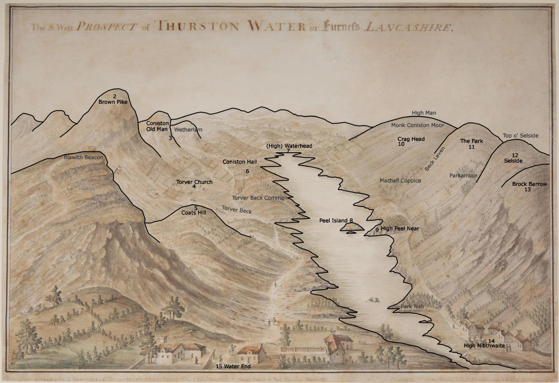
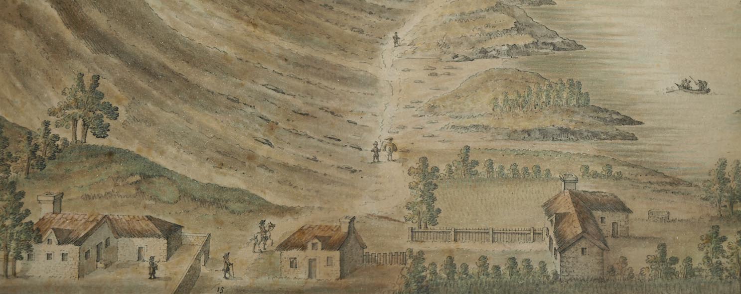
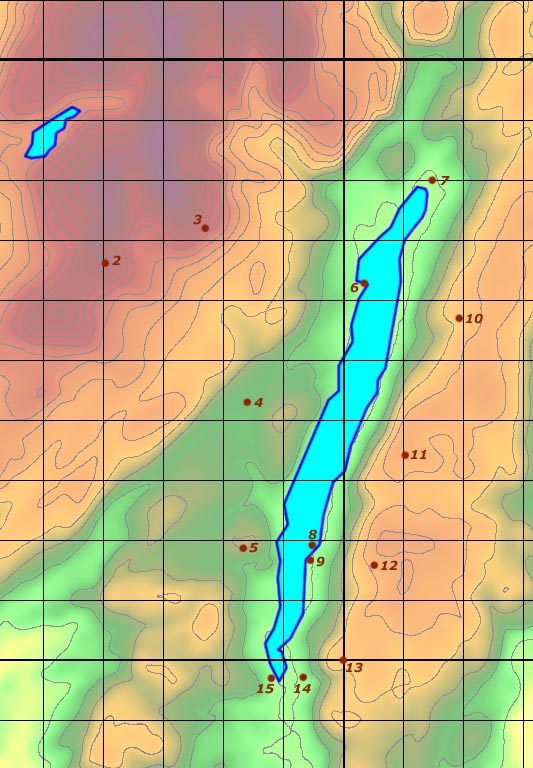
The painting is one of a series of four. Each scene has numbered features in the picture with a list of identifications, making them the precursors of 'outline views'. The place interpretations are ours.
|
||
| Outline View | ||
|
||
|
In the centre background is probably Fairfield with Seat
Sandal or Dollywagon Pike to the left, hiding Helvellyn.
Features in the view are labelled with a number linking to tabulated references at the top of the painting. |
||
| Objects in the View | ||
|
The viewpoint is the south end of Coniston Water, earlier
called Thurston Water. The direction of the view is NE, ie
from the SW. Numbered objects in the view can be identified
today, the names a little different. The identifications
list name, civil parish and grid reference.
|
||
|
|
||
| caption |
Painted at the bottom:-
[ ] 2 White pike 3 Dowcraigs. 4 Torver Church 5 Snaebe Harvey hill. 6 Coniston Hall. 7 Water Head 8. Peel island 9. Peelness. [ ] [Cha ] 12 Selsed hill. 13 Brookborough hill. 14 [ ] The numbers on the image are in black ink and clearly legible, where found. |
|
|
|
||
| [blank] |
Caption 1 is missing, and no number 1 has been found in
the image.
|
|
|
|
||
| 2 White pike |
Brown Pike, Dunnerdale-with-Seathwaite, SD26069660. Dow
Crags are hidden behind. Greenwood 1824 writes Dow Crag for
Brown Pike.
|
|
|
|
||
| 3 Dowcraigs. |
Old Man of Coniston, SD27239782.
Next to the right, not labelled on the painting, is Wetherlam. |
|
|
|
||
| 4 Torver Church |
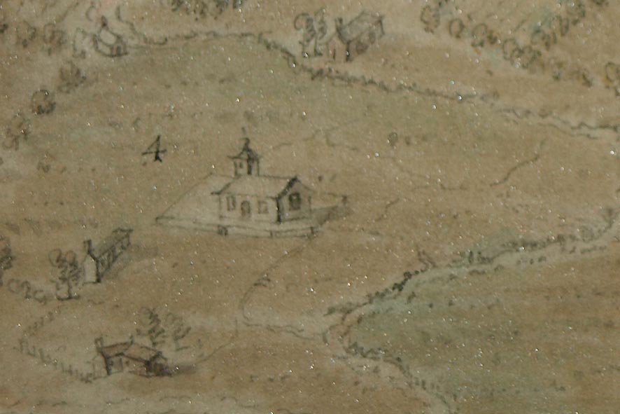
St Luke's Church, Torver, SD28469427. |
|
|
|
||
| 5 Snaebe Harvey hill. |
Coats Hill, Blawith and Subberthwaite, SD28459185.
|
|
|
|
||
| 6 Coniston Hall. |
Coniston Hall, SD30449634.
|
|
|
|
||
| 7 Water Head |
Water Head, Coniston, SD3198; specifically High Water
Head or Waterhead.
|
|
|
|
||
| 8. Peel island |
Peel Island, SD29519190.
|
|
|
|
||
| 9. Peelness. |
High Peel Near, Colton, SD29529173. This is a headland, a
'ness'.
|
|
|
|
||
| [illegiblecaption] |
No.10 on the picture is
Monk Coniston Moor, SD325969 (etc); the summit is High Man, Satterthwaite, SD32789650. |
|
|
|
||
| Cha[n]n[e]l |
The caption could be for 10 or 11. No.11 on the picture
is:-
The Park, Colton, SD310933; summit at SD31089352. |
|
|
|
||
| 12 Selsed hill. |
Selside, Colton, SD305916 etc; the sunnit is Top o'
Selside, SD30919193.
|
|
|
|
||
| 13 Brookborough hill. |
Brock Barrow, Dunnerdale-with-Seathwaite, SD22029428.
|
|
|
|
||
| 14 [Nib ] |
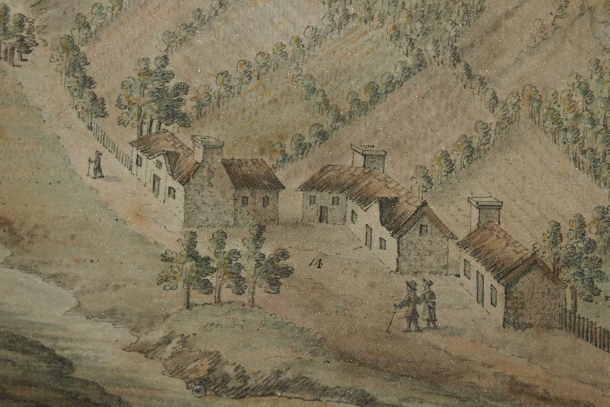
High Nibthwaite, Colton, SD293897. |
|
|
|
||
| [illegible caption] |
No.15 on the picture is:-
Lake Bank, Blawith and Subberthwaite, SD287897. Called High and Low Water End on the OS County series maps, 1890s. |
|
|
These places are located as:- |
||
|
||
Other Objects in the View |
||
|
Other objects in the picture can be recognized (labelled on the outline view image):- |
||
|
|
||
| Blawith Beacon |
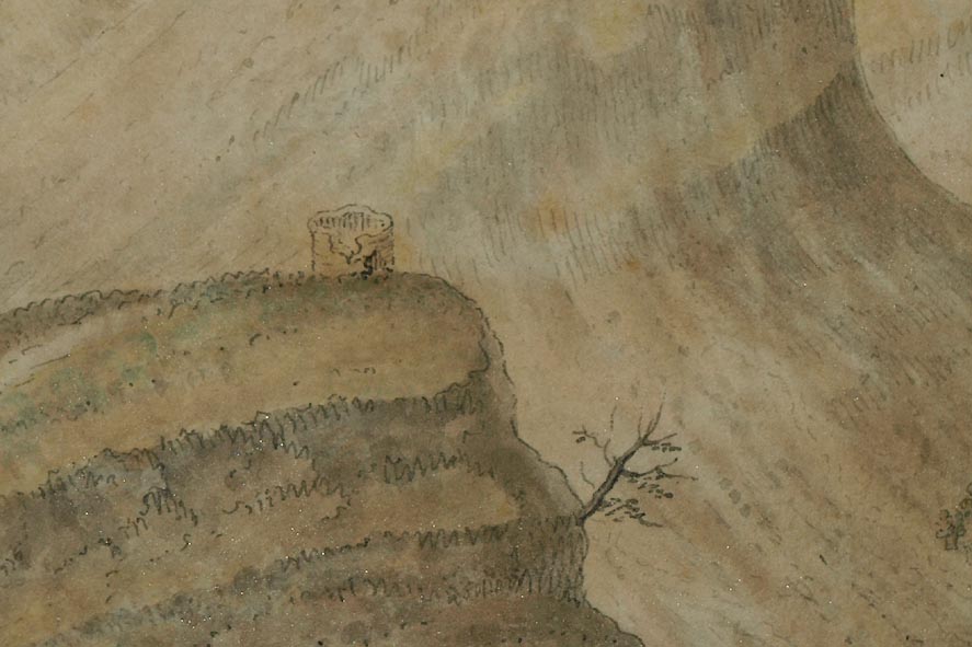
Hill and presumably once a beacon, Blawith and Subberthwaite, SD27799068. |
|
|
|
||
| Torver Beck |
at SD292922 etc.
|
|
|
|
||
| Torver Back Common |
in Torver parish, SD291934 etc.
|
|
|
|
||
| Beck Leven |
Beck at SD3195 etc, boundary of Coniston and
Satterthwaite where it runs into Coniston Water at Beck
Leven Foot, SD31929522.
|
|
|
|
||
| Machell Coppice |
in Satterthwaite parish, SD311949 etc.
|
|
|
|
||
| Parkamoor |
in Colton parish, SD309925 etc.
|
|
|
|
||
| fishing |
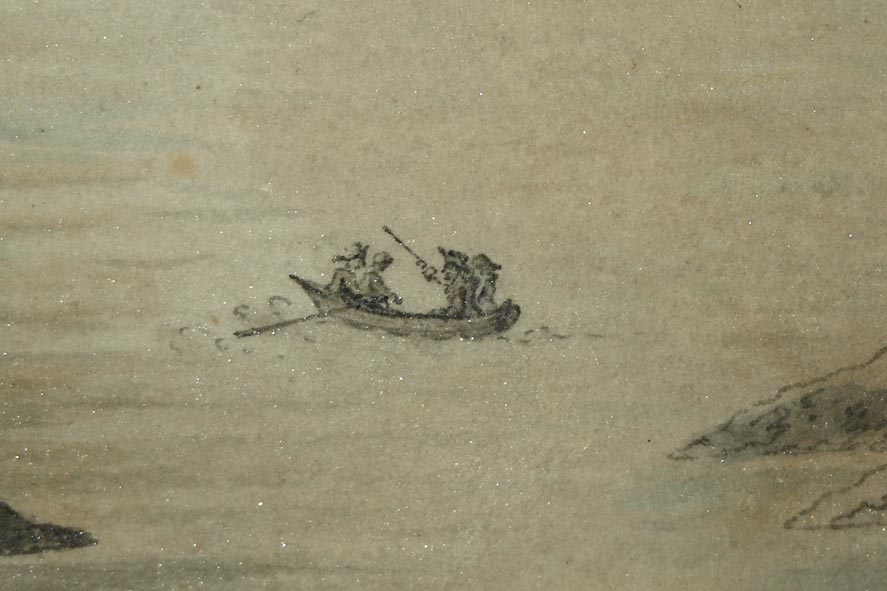
Fishing with rod and line, from rowing boat ... perhaps for char? |
|
Lakes Guides menu.