


This could be a fleur de lys or the Prince of Wales Feathers? Its height is about 4.5cm.

Printed at the bottom are the names of artist and engraver:-
Fran: Barlow inv: W. Hollar fecit [1675]
scroll cartouche
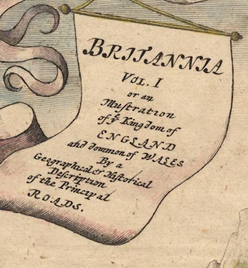
Three winged cherubs above hold banners hanging from a bow, a fourth banner hanging from the bow is a title cartouche:-
BRITANNIA VOL. I or an Illustration of ye Kingdom of ENGLAND and dominion of WALES By a Geographical & Historical Description of the Principal ROADS.
The ampersand clearly shows its source in a letter e with a cross stroke on the rising tail for a t, making the Latin 'et' ie 'and'.
road map
street map
roads
distances from London
orientation
compass rose
The 1st scroll is a strip road map titled:-
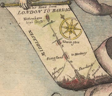
The Road from LONDON TO BARWICK
London is at the bottom with a road northeast to Harwic[ ]. The road north goes through Shorditch, Kingsland with turnings to Islington and Hackney, Newington, to Tottenham with its high Crosse, just over 5 miles into Middlesex. The miles from London are marked.
A compass rose on the scroll has star points for cardinal and half cardinal directions; North marked by a fleur de lys. Up the scroll is roughly north.
The 2nd scroll has a street map of:-
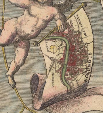
LONDON
with Westminster, Lambeth and Southwark labelled. This is orientated with North roughly at the top, the scroll held sideways. There is a simple compass rose, lines for the cardinal directions; fleur de lys for North, a cross for East.
The 3rd scroll has a road map of the area of:-
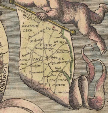
YORKSHIRE
and surrounding counties, parts of Westmorland, Lanc[ ]shi, Lincolnshire, etc. The map is a road map of the area, but not a strip map. This map is orientated with North at the top.
There is a scale line of:-
English miles
This is [surely] not meant as a serious scale to the map. Its 40 miles = 15.3mm gives a scale about 1 to 4200000, 66 miles to 1 inch. Measuring the positions of York, Lincoln and Durham does not reveal anything interesting, it wasn't likely to!
coat of arms

On the left of the scene is a city, a battlemented and decorated town gate fortified with cannons, lots of them. Above there is a flag with the royal arms. This royal standard is blowing left of the flagpole, for good design reasons no doubt, but the arms are shown the right way round. As the flag is viewed from the back the arms should be backtofront, which would be unacceptable.
The blazon is, forgive inadequacies in my use of the jargon:-
quarterly 1 and 4 quarterly i and iv azure three fleur de lys or for France, ii and iii or three lions passant guardant gules for England, 2 or a lion rampant gules within a double tressure flory counterflory gules for Scotland, 3 azure a harp argent for Ireland.
The royal banner of the Stuart kings. The particular colours used are those of a modern colourist. There are no colour letters in the engraving, nor shadings to indicate colours.

Just below the balustrade of the gate tower is a coat of arms in an oval scroll cartouche, carved in the stonework. This repeats the royal arms. There is a rose for England to its left, a thistle for Scotland to its right. Lower, in the arch of the gateway is another oval scroll cartouche with the coat of arms of the City of London; in less formal language:-
White with the red cross of St George and the red sword of St Paul in the canton.
road map

Lower left a group of men appear to be discussing a route. One of them holds a strip road map labelled:-
The Continacion of ye Roa[ ]
On which you can just see a bit of road and a compass rose.

One of two men leaving the city on horseback carries a strip road map; nothing legible except a compass rose indicating a road to the south.
instrument
globe
cross staff
compass
chain
simple theodolite
quadrant
protractor
set square
ruler
dividers
waywiser
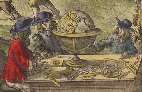
Lower right in the foreground are four surveyors or cartographers round a table littered with instruments: cross staff - a Jacob's staff, magnetic compass, surveyor's chain - perhaps Gunther's chain, simple theodolite - compass to align the scale, alidade with sights to take readings, and a quadrant; and drawing instruments - protractor, set square, ruler, and dividers. The globe is worth a close look. There are Africa and Europe, with the British Isles to the east, Ireland to the east of England. The engraver has made the elementary but understandable mistake of engraving the right way round on his plate; the picture prints backtofront.
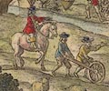
Less obviously, in the mid ground on the right, there is a man trundling a waywiser, measuring a road. An assistant helps, and a supervisor follows on horseback. Is this a good representation of a John Ogilby field party at work?

A man is fishing in a river using a conical net suspended from a pole.
sheep
cattle

In a field in the middle of the scene a huntsman on horse and foot men, one blowing a horn, and dogs, chase a stag. Cattle in the field and sheep and shepherd are all unperturbed.


The scene extends to a coastal town, town walls and town gate, towers, buildings, etc. In the harbour are ships, with other ships offshore. One of these is a three masted ship; sprit with yard for a square sprit sail, foremast with two square sails set, main mast with yards for three sails, only the top sail set, mizzen mast with a yard for a lateen sail. A smaller boat with a single square sail is nearby.

A heavy four wheeled coach pulled by two horses is on the road from the city, climbing a hill into the distance.
windmills

Atop the hill by road from the city is a post mill.

On a prominence overlooking the sea is a beacon. This appears to be a post, supported by braces, with a suspended fire basket or cresset.
 Britannia