item:- JandMN : 336.2
image:- © see bottom of page
 NS02.jpg
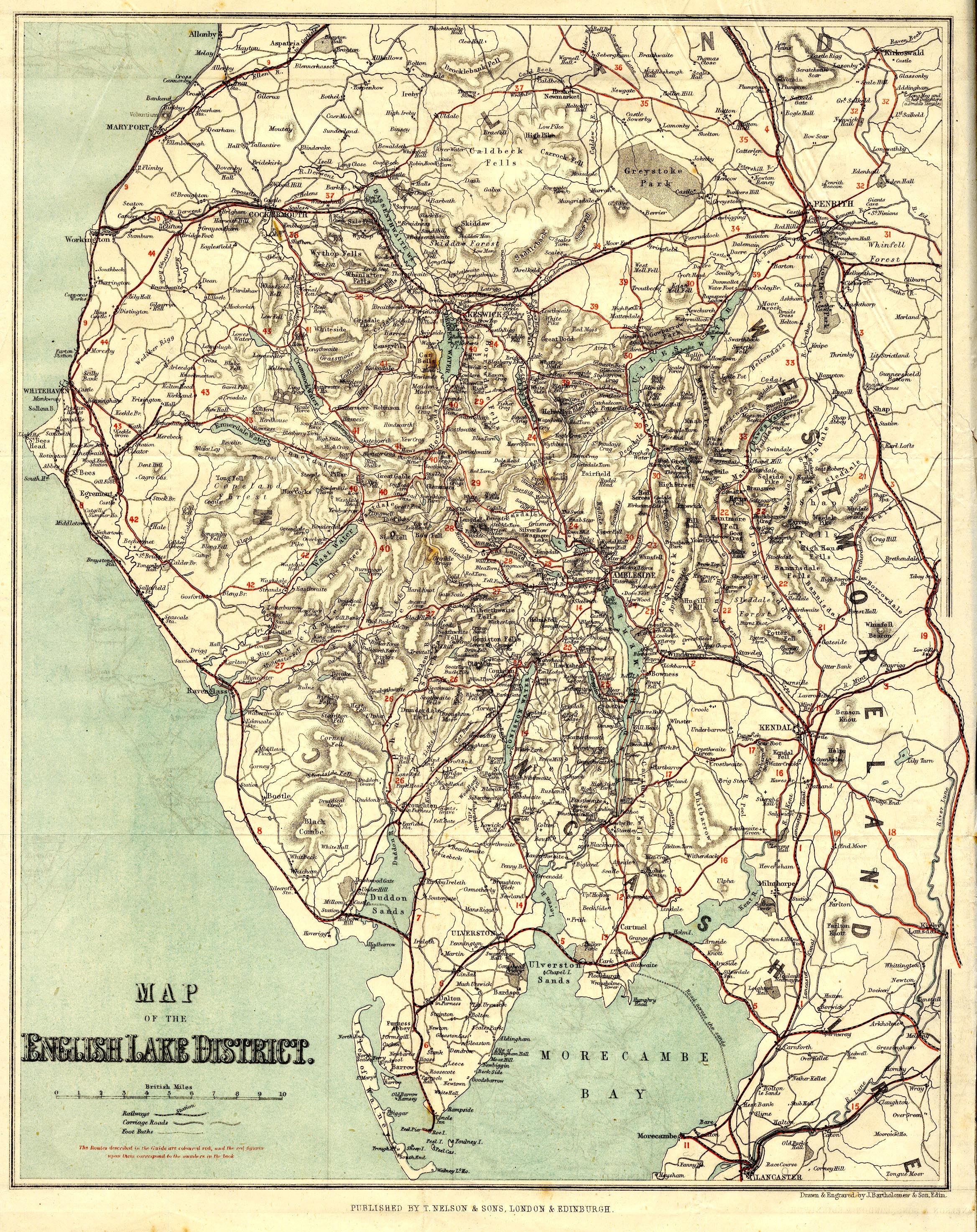
Map, colour lithograph, Map of the English Lake District, scale
about 3.5 miles to 1 inch, drawn and engraved by John
Bartholomew and Son, Edinburgh, published by T Nelson and Sons,
Paternoster Row, London, and Edinburgh and New York, United
States, 1859.
 Lakes Guides menu.