item:- JandMN : 173.5
image:- © see bottom of page
 MA12M5.jpg
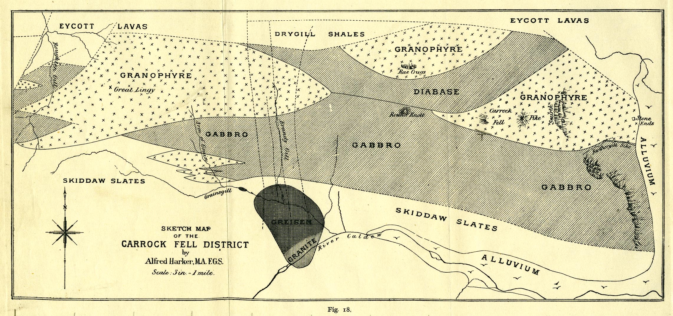
Geological map, uncoloured lithograph, Sketch Map of the Carrock
Fell District, scale about 3 inches to 1 mile, by Alfred Harker,
published by Cambridge University Press, Cambridge,
Cambridgeshire, 1916.
 Lakes Guides menu.