 Simons 1635

|

|
|
|
item:- private collection (50_22) image:- © see bottom of page |
click to enlarge |
|
|
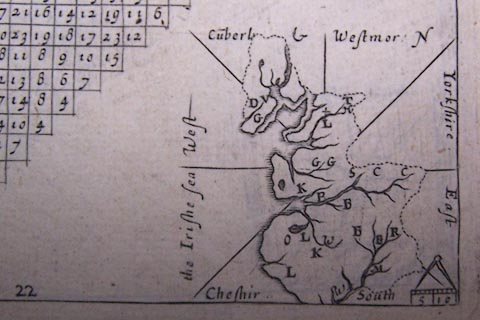
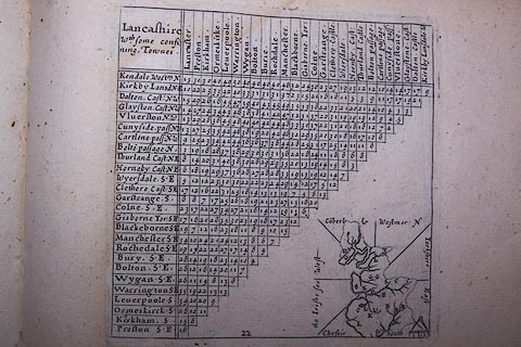
Table of distances, uncoloured engraving, Lancashire,
with a thumbnail map, by Mathew Simons, published in A
Direction for the English Traviller, 1635.
The county map is in the bottom right part of the page, below and beside the triangular distance table. |
||

|
Simons 1635 | |
| map feature:- | up is N & scale line & rivers & lakes & settlements & county | |
| inscription:- |
printed top left of table
Lancashire / wth. some confi / ning Townes |
|
|
||