 Census 1891 map

|

|
|
|
item:- Kendal Library (22_2) image:- © see bottom of page |
click to enlarge |
|
|
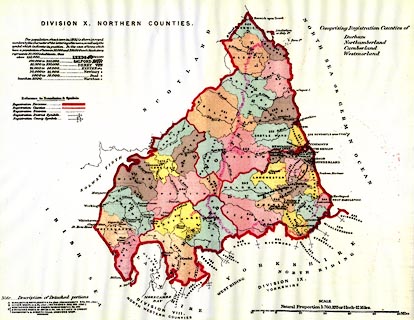
Map, colour lithograph, Division X Northern Counties,
Northumberland, Durham, Cumberland, Westmorland, for
extracts from the Census 1891, scale about 12 miles to 1
inch, published by HMSO, London, 1894.
Included in extracts of the Census of England and Wales, of 1891, for the North Western Counties and the Northern Counties, HMSO, 1894. |
||

|
Census 1891 map | |
| inscription:- |
printed upper left
DIVISION X. NORTHERN COUNTIES |
|
| inscription:- |
printed with scale line
SCALE / Natural Proportion 1 : 760,320 or 1 inch - 12 Miles. |
|
| scale line:- | 50+10 miles = 128.3 mm | |
| wxh, sheet:- | 42.5x31.5cm | |
| wxh, map:- | 369x290mm | |
| scale 1 to 750000 ? (1 to 752616 from scale line):- | ||