button to main menu Census 1891 map

item:-
Kendal Library (22_1)
image:-
©  see bottom of page
image, button to large image
click to enlarge


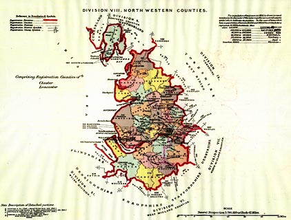
Map, colour lithograph, Division VIII North Western Counties, Lancashire and Cheshire, for extracts from the Census 1891, scale about 12 miles to 1 inch, published by HMSO, London, 1894.
Included in extracts of the Census of England and Wales, of 1891, for the North Western Counties and the Northern Counties, HMSO, 1894.
   Census 1891 map
inscription:- printed upper centre
DIVISION VIII. NORTH WESTERN COUNTIES
inscription:- printed with scale line
SCALE / Natural Proportion 1 : 760,320 or 1 inch - 12 Miles.
scale line:- 50+10 miles = 128.9 mm
wxh, sheet:- 42.5x31.5cm
wxh, map:- 375x298mm
scale 1 to 750000 ? (1 to 749113 from scale line):-