 Bazaar 1890

|

|
|
|
item:- JandMN (424) image:- © see bottom of page |
click to enlarge |
|
|
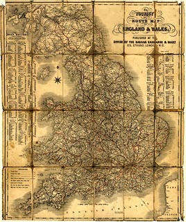
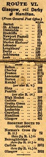
Road map, The Tourist Route Map of England and Wales,
published by the Bazaar Exchange and Mart Office, 170
Strand, London, about 1890.
|
||

|
Bazaar 1890 | |
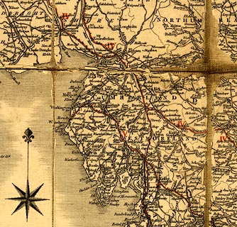
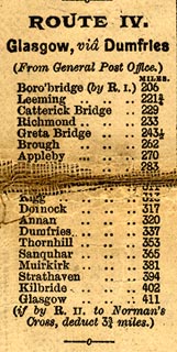
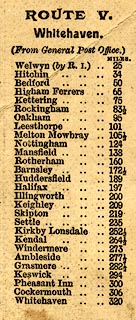
| map feature:- | sectioned for folding & mounted & compass rose & up is N & scale line & lat and long scales & sea shaded & coast shaded & rivers & county & settlements & roads & turnpike roads & road distances & distances from London & electoral data & railways & canals | |
| inscription:- |
printed title
The / TOURIST / ROUTE MAP OF / ENGLAND & WALES. / PUBLISHED AT THE OFFICE OF THE BAZAAR EXCHANGE & MART / 170, STRAND, LONDO[N] W.C. |
|
| scale line:- | 60 miles = 99 mm (roughly) | |
| wxh, sheet:- | 64x76cm | |
| scale:- | 1 to 1000000 ? (estimates) | |
|
||
|
||
|
||
|
||
|
|
notes | |