 BP 1950s

|

|
|
|
item:- JandMN (189) image:- © see bottom of page |
click to enlarge |
|
|
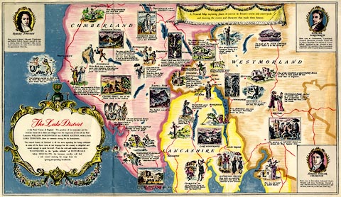
Pictorial map, colour lithgraph, The Lake District, scale
about 3.5 miles to 1 inch, by Goetz, published by BP, about
1950.
The map is illustrated with scenes of places and events, and has vignettes of Robert Southey, William Wordworth, and Samuel Taylor Coleridge. The reverse has descriptions of Some Sights to See. |
||

|
BP 1950s | |
| map feature:- | scroll cartouche & vignettes & up is N & sea tinted & coast line & lakes & county & settlements & roads & descriptive text | |
| inscription:- |
printed title cartouche, lower left
The Lake District / is the Poets' Corner of England. ... |
|
| inscription:- |
printed lower left
Goetz |
|
| inscription:- |
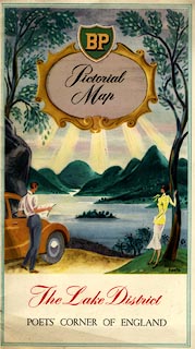
printed cover
BP / Pictorial / Map / The Lake District / POETS' CORNER OF ENGLAND view of ?Derwent Water |
|
| wxh, sheet:- | 43x25.5cm | |
| wxh, map:- | 420x244mm | |
| scale:- | 1 to 220000 ? (estimate) | |
|
||