
Carlisle Library : Map 286
image:-
© Carlisle Library

click to enlarge
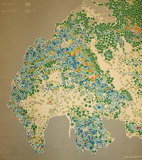
Circular symbols are plotted for each farm? size and colour showing size and type.

Types of Farm / in the / Northern Regions
The type of farm has been determined according to the method described in / FARM CLASSIFICATION IN ENGLAND AND WALES 1963. (H.M.S.O. 1965) / ...
Compiled and drawn by the cartographic staff of the Northern region / Agricultural Development and Advisory Service, Ministry of Agriculture, / Fisheries and Food, Newcastle. / Based on parish statistics derived from the June 1968 Agricultural Census.
... 1971. Ministry of Agriculture, Fisheries and Food
MILES
 Ministry of Agriculture 1971