 Post Office 1823

|

|
|
|
item:- British Postal Museum and Archive (8) image:- © see bottom of page |
click to enlarge |
|
|
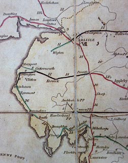
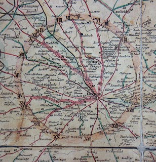
Copy of a post road map, The Circulation of Letters, a
General Post Office Circulation Map for England and Wales,
General Post Office, London, 1823.
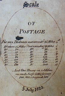
The London routes have a roman number which refers to a list of mail coaches from the capital; those routes are emphasized by a numbered ring around London. The map has a 'Scale' of postage rates. |
||

|
Post Office 1823 | |
| map feature:- | up is N & table of symbols & settlements & post roads | |
|
||
|
||