 Roberts c1800

|

|
|
|
item:- Bristol Museums : T9119 image:- © see bottom of page |
click to enlarge |
|
|
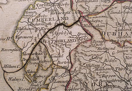
Jigsaw puzzle, mahogany, hand coloured engraving, map,
New Map of England, by ?J Roberts, London? about 1800.
England and Wales divided into counties, the boundaries tinted; the map originally had a border with latitude and longitude scales and probably other map features which have been cut away. |
||

|
Roberts c1800 | |
| jigsaw feature:- | hand coloured & hand cut & 60 piece (about 58) & big piece & picture outline (country plus sea) & interlocking border & non interlocking pieces & picture pieces (counties) & sliding lid box | |
| inscription:- |
printed oval label on box lid
A / NEW MAP [O ] / ENGLA[ND ] / divided [ ] / [ ] / [by] / J. ROBERTS |
|
| map feature:- | up is N & lat and long scales & county & settlements & roads | |
| wxh:- | 35x36cm | |
| lxwxd:- | 14x17x6.5cm | |
|
|
notes | |