 Unknown 1800s

|

|
|
|
item:- Carlisle Library : Map 330 image:- © Carlisle Library |
click to enlarge |
|
|
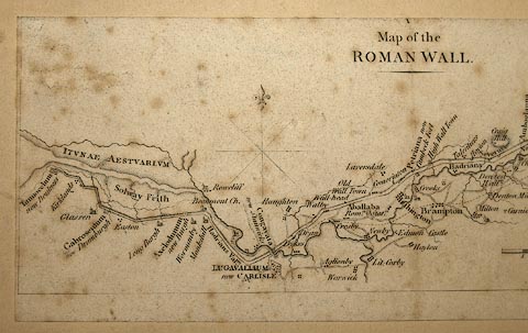
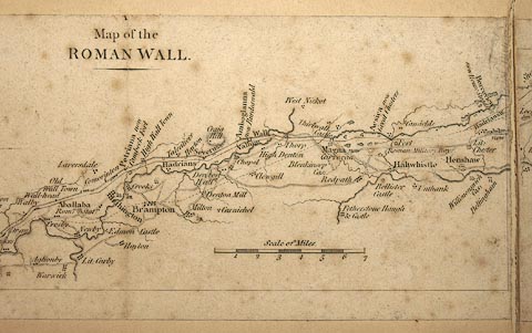
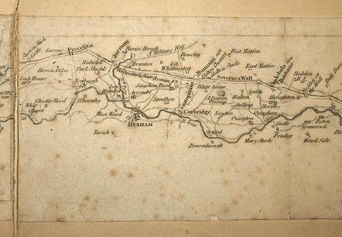
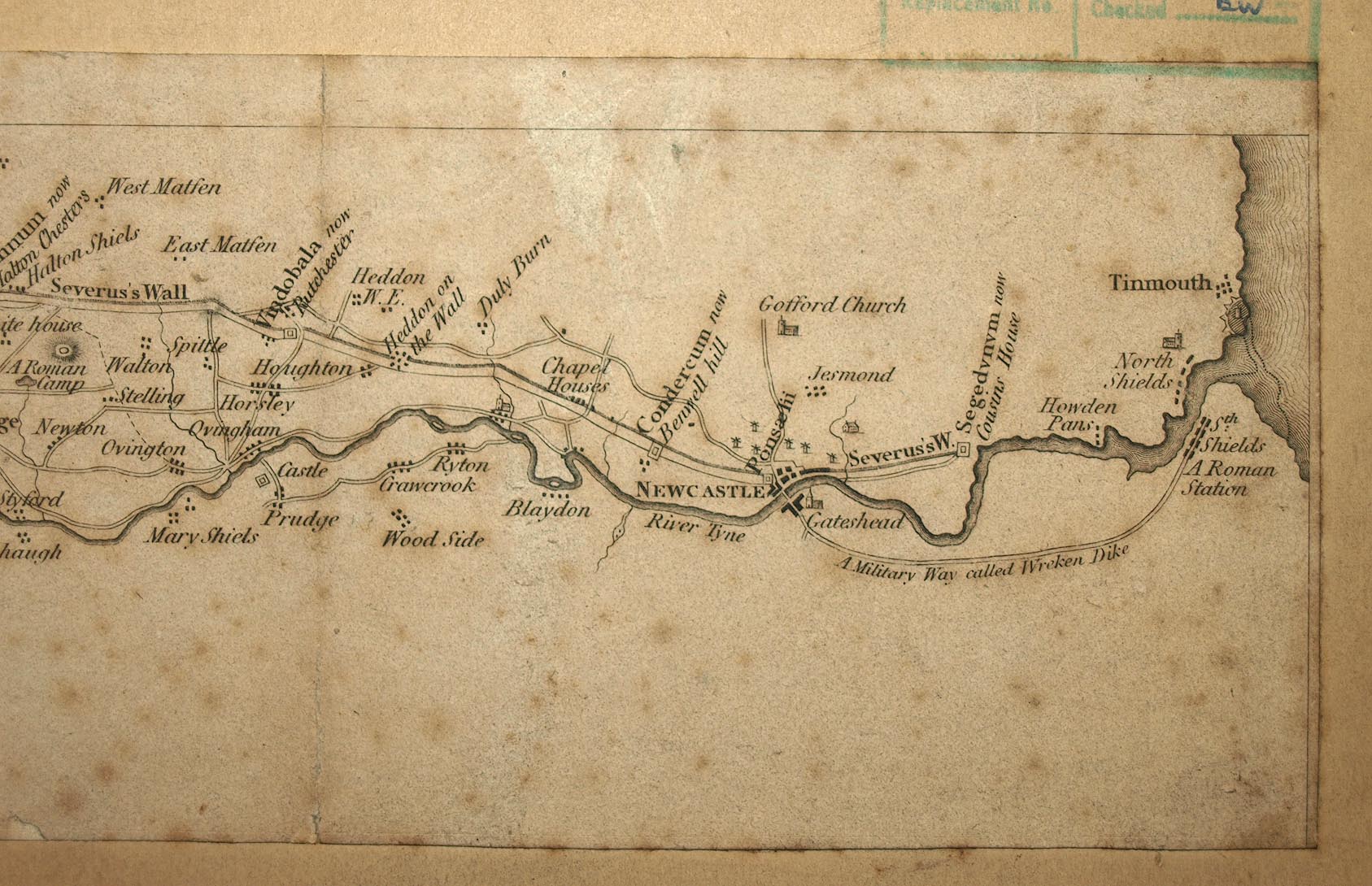
Map, uncoloured engraving in four pieces, Map of the
Roman Wall, Cumberland and Northumberland, scale about 4
miles to 1 inch, early 19th century??
|
||

|
Unknown 1800s | |
| map feature:- | compass rose & up is N & scale line & sea plain & coast line (on W) & coast form lines (on E) & foreshore sands & rivers & relief & hill hachuring & settlements & roads & roman sites & roman roads | |
| inscription:- |
printed upper left
Map of the / ROMAN WALL |
|
| inscription:- |
printed with scale line
Scale of Miles |
|
| scale line:- | 7 miles = 44.0 mm | |
| wxh, sheet:- | 51.5x19.5cm (about) | |
| wxh, map:- | 46.8x8cm | |
| scale:- | 1 to 260000 ? (1 to 25603 from scale line) | |
|
images:- © Carlisle Library |
|
|
|
||
|
||