 Geddes 1848

|

|
|
|
item:- Carlisle Library : Map 91 images:- © Carlisle Library |
click to enlarge | |
| Illustration of part of map only. | ||
|
Chart, uncoloured engraving, Sketch of the English
Channel from the Bar up to Port Carlisle, in the Solway
Firth, scale about 2 ins to 1 mile, by W Geddes, 1848.
|
||

|
Geddes 1848 | |
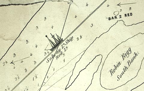
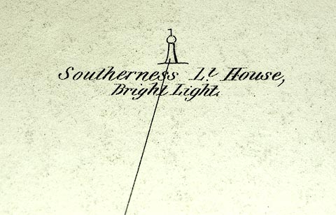
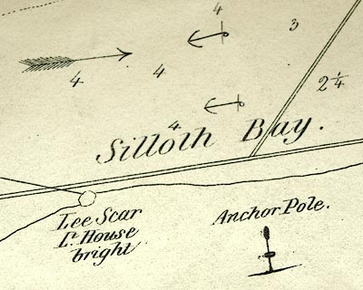
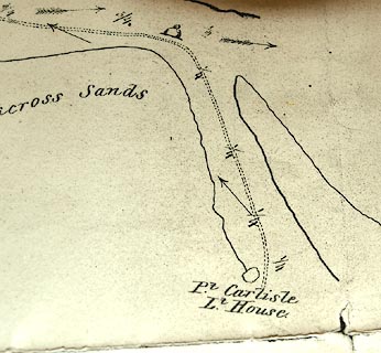
| map feature:- | table of symbols & compass rose & up is N (NNWbyN) & scale line & sea plain & depth soundings & tidal streams & anchorages & leading lines & coast line & coast views & headlands & sandbanks & foreshore sands & lighthouses & buoys & sea marks & settlements | |
| inscription:- |
printed lower right
A Rough Sketch / OF THE / ENGLISH CHANNEL, / FROM THE / BAR, UP TO PORT CARLISLE, / by / W. GEDDES, / Superintendant of Lights & Buoys, / FOR THE / CARLISLE CANAL COMPANY, / 7th. Novbr. / 1848. |
|
| inscription:- |
printed with scale line
Scale of One Mile |
|
| scale line:- | 1 mile = 51.2 mm | |
| wxh, sheet:- | 100x67cm | |
| wxh, map:- | 963x625mm | |
| scale:- | 1 to 31000 ? (1 to 31432 from scale line) | |
|
images:- © Carlisle Library |
|
|
|
||
|
||