 Unknown 1860

|

|
|
|
item:- Carlisle Library : Map 45 image:- © Carlisle Library |

click to enlarge |
|
|
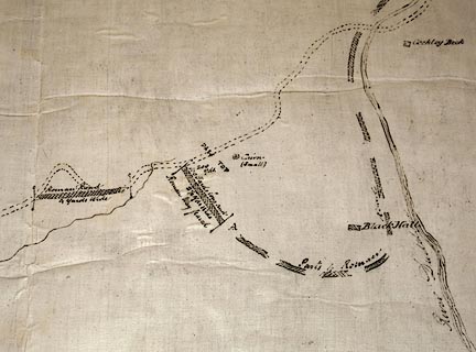
Map, manuscript ink on paper, Sketch of the Pass into
West Cumberland, ie Hardknott Pass, Eskdale, scale about 25
ins to 1 mile, 1860.
|
||
| map type:- | Unknown 1860 | |
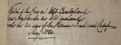
| inscription:- |
ms upper left
Sketch of the Pass into West Cumberland / [from] Ambleside in Westmorland / with the remains of the Roman Road and Camp / May 1860. |
|
| wxh, sheet:- | 76x51.5cm | |
| scale:- | 1 to 2600 ? (estimated from size of fort and bathhouse) | |
images:- © Carlisle Library |
|
|
|
||