 Roman Roads, Cumbria

|

|
|
|
item:- Carlisle Library : Map 40 image:- © Carlisle Library |
click to enlarge |
|
|
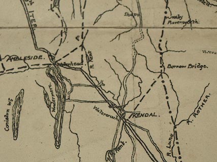
Road map, uncoloured lithograph? roman roads in Cumbria,
scale about 9.5 miles to 1 inch, early 20th century?
This is apparently a proof copy, with corrections marked in red. |
||
| map feature:- | table of symbols & sea plain & coast form lines & rivers & lakes & parks & settlements & roads & roman roads & sands roads | |
| inscription:- |
printed table of symbols, lower left
Ordinary Roads [single line, dashed] X / The Maiden Way [single line, dash dot] / The Carelgate or Stanegate [single line, dash dot dot] / The 2nd Iter [single line, solid, bold] / The 10th Iter [double line, solid, light] X the Xs show entries to be printed in red |
|
| inscription:- |
printed table of symbols, additional
Modern Roads [double line, solid, light] / The Roman Wall & its Road [castleated single line, bold] |
|
| wxh, sheet:- | 28.5x44.5cm | |
| wxh, map:- | 21.5x26cm | |
| scale:- | 1 to 610000 ? (estimated) | |